Crashes, No Sound, or Screen Glitches?
Random freezes, missing sound and display glitches usually trace back to one bad driver. Find and replace yours safely.Free scan · under a minutePC Slower Than It Used to Be?
A free scan shows the junk files, broken settings and background clutter dragging Windows down - then fixes them in one click.Free scan · Windows 10 & 11Set up a Leica X-PAD GNSS rover by preparing the project and coordinate system, confirming that your receiver and software are compatible, assembling the pole, connecting the controller and receiver, and verifying RTK status and a known point before collecting survey data. The exact connection menus and correction settings depend on your receiver, X-PAD release, and RTK service; use the current instructions for that combination rather than assuming one universal setup.
Prepare the project and coordinate system first
Before field measurement, create or open the X-PAD project and import the required job data, CAD drawings, and stakeout information. Set the project’s coordinate system and check its datum, reference frame, and height treatment against the project control and local specifications. The right choice depends on the project and jurisdiction, so do not select a system simply because it is a familiar regional default.
As an Amazon Associate I earn from qualifying purchases.
Leica describes X-PAD as a workflow that covers data preparation, field measurement and stakeout, verification, and office processing. Its guidance stresses that the correct grid coordinate system and reference frame are essential to placing GNSS results in the intended project location. Leica’s X-PAD overview
What’s actually slowing this PC down?
Pick the symptom - the matching free tool is one click away.
Check compatibility before connecting equipment
Confirm compatibility across the installed X-PAD release, Android device, controller, GNSS receiver, and receiver firmware. Leica’s current X-PAD overview identifies the GS11 and GS05 GNSS smart antennas as compatible and says X-PAD runs on Android tablets and smartphones. It describes the Leica CSX8 as an optimized rugged field tablet. These listings are not a guarantee that every older Leica receiver or every Android device works with every software release; check current Leica documentation or support for your exact combination.
#1 Best Overall

- 【Full-Constellation, Fixed in Seconds】E1 gnss rtk achieves stable fixed solution rapidly, even in challenging environments like multipath, tree canopy, and city canyons.E1 is equipped with a high-precision GNSS engine for simultaneously tracking GPS, BDS, GLONASS, Galileo, QZSS, IRNSS & SBAS.
- 【RTK Corrections Service/CORS Requirement】The E1 rover must connect to an RTK corrections service or a Continuously Operating Reference Station (CORS). You can purchase a third-party RTK service account or set up a GSM base station to get an RTK FIX solution. Check if your location is covered by CORS; you may need to buy local CORS services.
- 【Over 20hrs Operation】With optimized charging safety and internal battery design, E1 gnss survey equipment offers over 20 hours of continuous operation on a single charge, with fast charging support via Type-C port.
- 【5 Kilometers】E1 RTK GNSS Surveying System with IMU has a long transmission distance, Radio range between the rover and the base can reach 5 kilometers (3.1miles). Also E1 can compatible with base stations of other brands in both Radio and CORS mode. Support RTCM v3/CMR correction data transmission.
- 【60° Tilt, 5s Initialization】Our rtk gps equipped with a new generation IMU module, E1 initializes in just 5 seconds and allows tilt measurements up to 60°, ensuring ±2.5cm accuracy for the entire work.
Install X-PAD through the Leica customer portal on a supported Android device and activate it using the entitlement details supplied with your purchase. Leica’s GS11 announcement, dated 14 September 2026, describes a portfolio integrating X-PAD software, selected instruments, and connected services, and highlights live-view guidance and image-based measurement with the GS11. Leica’s GS11 and X-PAD portfolio announcement
Assemble and inspect the rover
- Choose a survey pole and adapter that are compatible with the receiver’s mounting thread and configuration.
- Seat the antenna or instrument fully and secure its locking mechanism. Leica warns that incorrect mounting directly affects results.
- Attach the field controller to the pole if that arrangement suits your equipment and workflow.
- Check that the pole is straight, stable, and undamaged before use.
Leica’s rover equipment guide illustrates a pole-mounted receiver and a controller connected to the GNSS instrument by Bluetooth. It is a legacy Viva GNSS guide, however, not a universal parts list or current menu guide for every X-PAD setup. Consult the manual for your specific receiver. Leica Viva GNSS rover equipment guide
Rank #2

- 【60°Tilt Surveying】E1 Lite GNSS Surveying System with IMU, can initializes in 5 seconds and supports tilt measurements up to 60°, and compatible with regular 5/8" thread poles.
- 【20 Hours Endurance 】E1 Lite rtk handheld gps provides 6700mah over 20 hours of continuous operation on a single charge, with fast Type-C charging. It employs a base station and rover with the (GPS) to attain Centimeter-Level Precision Measurement, High precision with low power consumption, small size easy to carry and operate.
- 【10-15 Kilometers】E1 Lite GNSS RTK Survey equipment with IMU has a long transmission distance, radio range between the rover and the base can reach 10-15 kilometers (6.21-9.32miles). Also E1 Lite can compatible with base stations of other brands in both Radio and CORS mode. Support RTCM v3/CMR correction data transmission.
- 【Robust Signal Tracking】E1 Lite RTK support Full-Constellation Tracking: GPS/GLONASS/Galileo/BDS/QZSS/IRNSS/SBAS etc, an easily obtain fixed RTK solution in seconds even in challenging environments like multipath, trees, and city canyons.
- 【Various Interfaces】E1 Lite gps rtk Innovative integration of multiple connection methods: NFC (Touch connection) /Bluetooth/USB Type-C/WiFi/TNC Connector/RS232 Serial Port. Easily access static data download, Configuration, device Status check, and Firmware Upgrade.Improve your work efficiency by 30%!!
Connect the receiver and configure RTK corrections
Open the receiver and connection settings in your installed X-PAD version, then follow the instructions for the selected GNSS receiver. The exact pairing sequence and labels vary, so do not rely on a button-by-button procedure written for a different device or release.
Free tools Windows power users keep installed
One-click scans. No signup required.
Choose a correction route supported by your receiver, subscription, and work site. Common arrangements include a network RTK service or a local base-and-radio setup. Depending on the route, you may need working cellular data or internet access, radio settings, an account, and service-specific connection details such as a mountpoint. Leica identifies Hexagon SmartNet as a correction service for GS11 and GS05 users, but the cited product information does not establish coverage, subscription terms, login values, or a universal configuration sequence. Verify those details for your region and receiver with the service provider and current Leica instructions. Leica’s X-PAD overview
Rank #3
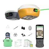
- 【Centimeter RTK Performance】 Full-Frequency L1-Laser/Z1 GNSS RTK support with 1408-channel L1/L2 GNSS engine delivers 5-second initialization and centimeter accuracy under trees and urban canyons, supporting GPS/GLONASS/Galileo/BDS/QZSS/SBAS.
- 【Laser + GNSS Hybrid Survey】Our L1-Laser gps rtk Integrated laser enables 10m non-contact measurement for inaccessible points such as powerlines and bridge edges while maintaining centimeter precision.
- 【120° Tilt Compensation】High-grade IMU supports ±60° tilt with auto-calibration, achieving 2cm accuracy at maximum tilt for faster, pole-free topographic surveys.
- 【15km UHF Radio】 SingularXYZ L1 GNSS built-in Built-in 2W UHF transceiver provides up to 15km rover-base range and supports RTCM/CMR, compatible with third-party bases and CORS/NTRIP workflows.
- 【AR Stakeout】Paired with the handheld collector, SingularPad enables AR stakeout—overlaying virtual point guidance on the camera view for faster, intuitive field layout.
Verify the setup before collecting points
Use a known control point or another independent project check required by the survey specification before relying on new measurements. If the check is unexpectedly offset, stop and resolve the cause rather than collecting production points on the assumption that the rover is correct.
- Coordinate context: Confirm that the intended project coordinate system and reference frame are active.
- Pole and antenna height: Enter the height and measurement method appropriate to the actual setup; check the value before recording points.
- Correction and solution status: Confirm that the receiver is receiving the intended corrections and reports a usable solution for the work.
- Mounting and pole position: Make sure the receiver remains secure. Keep a conventional survey pole vertical unless the receiver and workflow explicitly support tilt compensation.
- Independent check: Compare a measurement on known control with the expected project position and investigate discrepancies against the project’s tolerances.
Measure, review, and deliver the work
Once the checks pass, use the appropriate X-PAD measurement or stakeout workflow for the job. Review collected points and their coordinate context in the field, and complete the project’s required verification and reporting before leaving the site. Leica describes X-PAD Fusion as the office component for processing GNSS data, managing CAD data, preparing stakeout information, and producing deliverables. Leica’s X-PAD overview
Rank #4
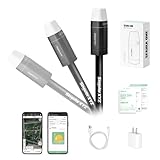
- 【Why Choose Sfaira ONE Plus?】Our gnss rtk is Up to 60° tilt surveying, pocket-size portability, and a 16-hour battery. Sfaira ONE Plus tracks GPS, BDS, GLONASS, Galileo, and QZSS for a professional and efficient surveying experience.
- 【Wide Applications】The accurate coordinates, elevation, distance and azimuth data measured by rtk gps Sfaira ONE Plus can be used in land surveying, GIS, mine surveying, topographic survey, cadastral survey, road stakeout, robotics, etc.
- 【How to use?】 ① Connect the Sfaira ONE Plus with your phone via Bluetooth. ② Login to your CORS account (RTK corrections service) in the software or connect to your RTK base station of internal GSM mode and get fixed RTK solution. ③ Initialize the tilt IMU function - shake the pole for 5 seconds. ④ Start working: the software supports Point Survey, Detail Survey, CAD Mapping, CAD stakeout, Road Stakeout, Surface Stakeout, Layer Editting and wide calculation functions.
- 【Software Free Upgrade】The android-based field surveying software can be installed on your smart phones, data collectors and tablets. The latest upgraded software version is always available for every user.
- 【Easy to get started】Tutorial videos, detailed manual and online one-to-one technical support can definitely help every user to get started with gnss surveying equipment Sfaira ONE Plus easily without concerns.
When setup instructions do not match your equipment
If a menu, receiver, controller, or correction field differs from an instruction you have, check the receiver-specific X-PAD documentation and current release guidance. Compatibility, firmware support, Android requirements, cellular access-point settings, service mountpoints, and regional correction coverage can all be device- or service-specific. Ask Leica support or the correction-service provider to confirm the exact configuration rather than transferring settings from another rover.
Quick Recap
Best Value
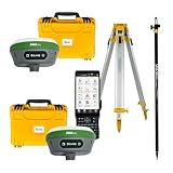
- 【High Capability & Compatibility】 The SMA26 Plus is an full-constellation RTK GNSS receiver with wide protocol compatibility, making it compatible with multiple RTK brands. Supporting PPP, PPK, and RTK technologies, it delivers versatile, high-precision performance for a wide range of surveying applications
- 【Tilt Compensation】 The SMA26 Plus RTK offers tilt measurement accuracy of up to 2.5 cm (at tilt angles ≤30°), after simple initialization, it is suitable for precise measurements in locations with limited signal or restricted space. The maximum tilt measurement angle is 60°
- 【Wide Protocol Compatibility】 SMA26 Plus GNSS RTK capable of receiving and broadcasting signals compatible with CSS(Lora),Transparent, TT450S,Trimtalk, TRMMARK3, SOUTH, SATEL standard radio protocols. ensuring compatibility with a wide range of rover&base stations
- 【Smart Handheld Collector】The SMA26 Plus GPS receiver is paired with an Android 11 handheld with 5.45" HD screen, dual SIM, 9000mAh battery, NFC, IP68 protection, dual-band RTK support, and 13MP rear camera
- 【All-in-One Integration】 The SMA26 Plus RTK GNSS receiver features built-in Bluetooth, UHF radio, WiFi, IMU, antenna, and 32GB of storage. It allows for easy switching between base station and rover modes with a single device
Product prices and availability are accurate as of the date/time indicated and are subject to change. Any price and availability information displayed on Amazon at the time of purchase will apply.




