Plan your Milwaukee I-94 trip by matching the day’s origin, destination, direction and required ramp to the closure that affects that movement. WisDOT’s October 7, 2026 announcement scheduled a traffic switch during the week of October 12 between Hawley Road and General Mitchell Boulevard, plus long-term closures at the General Mitchell Boulevard interchange through spring 2027. Those were announced plans, not a guarantee that the switch is complete or that every listed closure is active today. Check the WisDOT I-94 East-West project information and 511 Wisconsin immediately before each trip, then follow the work-zone signs.
Milwaukee I-94 closures and switches to check first
The East-West Freeway project does not create one uniform delay or one alternate route for every traveler. A closure may matter only if it blocks the entrance, exit or direction you need. The following schedule reflects WisDOT announcements available on October 11, 2026; weather, staging and field conditions can change it.
As an Amazon Associate I earn from qualifying purchases.
| Location and movement | Announced work or restriction | Timing stated by WisDOT | What to verify before driving |
|---|---|---|---|
| I-94 between Hawley Road and General Mitchell Boulevard | Traffic is scheduled to shift to the outside lanes so crews can work in the median. | Traffic switch scheduled during the week of October 12, 2026. | Whether the switch has occurred, which lanes are carrying each direction, and any temporary ramp changes. |
| Eastbound I-94 exit to General Mitchell Boulevard | Long-term exit closure. | Through spring 2027. | Whether the exit is closed on your travel date and which signed exit serves your destination. |
| General Mitchell Boulevard entrance to westbound I-94 | Long-term entrance-ramp closure. | Through spring 2027. | Whether the ramp is open for your trip; do not assume the opposite-direction ramp is interchangeable. |
| All General Mitchell Boulevard ramps | WisDOT says the ramps will be open and available on Brewers home playoff gamedays. | Exception applies on those gamedays during the announced closure period. | The specific game-day traffic plan, police direction and live 511 status. |
| Eastbound I-94 from 35th Street to 25th Street | Long-term eastbound lane closure. | Through late 2026. | Current lane configuration, queue location and whether additional work has changed access. |
| 35th Street entrance ramp to eastbound I-94 | Long-term ramp closure associated with the 35th-to-25th Street work. | Through late 2026. | Whether the ramp remains closed and which signed detour applies that day. |
| WIS 175 southbound ramp to eastbound I-94 | Long-term ramp closure. | Scheduled from late summer to late 2026. | Current ramp status and an alternative connection to eastbound I-94. |
| Westbound I-94 from the Marquette Interchange to the Stadium Interchange | Long-term westbound lane closure. | Scheduled from late summer to late 2026. | Whether the lane closure is active, narrowed or moved to another stage. |
The October 7 announcement describes planned work. Do not treat a scheduled switch as completed until the project page, 511 map or roadside signs confirm the operating pattern.
Recommended Free Tools
Start with a precise trip profile
Before choosing a route, write down five details. They determine whether a particular closure is relevant:
#1 Best Overall

- Bright, high-resolution 5” glass capacitive touchscreen display lets you easily view your route
- Get more situational awareness with alerts for school zones, speed changes, sharp curves and more
- View food, fuel and rest areas along your active route, and see upcoming cities and milestones
- View Tripadvisor traveler ratings for top-rated restaurants, hotels and attractions to help you make the most of road trips
- Directory of U.S. national parks simplifies navigation to entrances, visitor centers and landmarks within the parks
- Origin: your actual starting street, not just a suburb or neighborhood.
- Destination: the driveway, facility or downtown block where you must arrive.
- Direction: eastbound or westbound on I-94, including where you join and leave the freeway.
- Required ramp: the exact entrance or exit, such as the eastbound General Mitchell exit or the General Mitchell entrance to westbound I-94.
- Time and flexibility: your departure window, appointment time, parking deadline and whether another mode is possible.
This prevents a common mistake: seeing an I-94 closure on a map and assuming every Milwaukee trip needs the same detour. A traveler who never uses the affected ramp may need only to account for slower lanes, while a traveler whose destination depends on that ramp needs a complete approach plan.
How to check conditions before every commute
- Open the WisDOT I-94 East-West construction information. Review the project’s current closure, ramp and staging notices. Look for the date or time attached to each item; a late-2026 schedule is not proof that work is active on a particular morning.
- Open 511 Wisconsin. Use the website or app to inspect current lane closures, ramp restrictions, incidents, cameras, traffic speeds, displayed travel times and roadwork. The app also supports personalized routes and alternatives.
- Zoom to both ends of your trip. Check the freeway segment and the surface-street approach to the entrance or exit. A route can appear open on I-94 while the ramp or a connecting street is restricted.
- Compare at least two feasible plans. Test a freeway route, a local or regional alternate and, when practical, a different departure time or transit trip. Compare what each plan does at your actual endpoint rather than selecting the first suggestion.
- Read the map’s warnings and camera views. 511 routing may not include every construction, incident or weather closure. Treat a suggested path as an estimate to investigate, not a guarantee that every lane and ramp is available.
- Recheck just before leaving. The October 7 work is weather dependent and subject to change. A crash, a new lane stage or a game-day operation can alter the practical route after your initial check.
- Put the phone away before moving. Check conditions while parked or have a passenger handle updates. If you must use the phone service while driving, use hands-free service and keep safety first; never read the map or type while in traffic.
Match the plan to the closure you actually need to pass
Trips that need the General Mitchell Boulevard eastbound exit
The announced eastbound exit closure means a trip destined for the airport area, nearby businesses or another General Mitchell Boulevard address may require a different signed exit and a surface-street approach. Do not turn around on the freeway or cross lanes late to reach a closed gore. Use the live map to identify the next available exit, then inspect that exit’s approach for incidents and queueing. On a Brewers home playoff gameday, WisDOT says all General Mitchell Boulevard ramps will be open; verify that exception on 511 and obey event-day signs because traffic control can still change how you reach the ramps.
Trips entering westbound I-94 from General Mitchell Boulevard
If your normal westbound start is the General Mitchell Boulevard entrance, the scheduled closure requires you to reach westbound I-94 through another open entrance. Compare the complete path from your origin to that entrance, including any surface streets that may be carrying diverted traffic. A nearby ramp is not automatically faster or open, so confirm its status and the direction it serves.
Rank #2
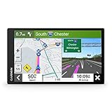
- 6” high-resolution navigator includes map updates of North America
- Hands-free calling when paired with your compatible smartphone with BLUETOOTH technology and convenient Garmin voice assist lets you ask for directions to places you want to go
- Road trip–ready features include the HISTORY database of notable sites, a U.S. national parks directory, Tripadvisor traveler ratings and millions of Foursquare POIs
- Driver alerts for things such as school zones, sharp curves and speed changes help encourage safer driving and increase situational awareness
- Access live traffic, fuel prices, parking, weather and smart notifications when you pair this navigator with your compatible smartphone running the Garmin Drive app
Eastbound trips near 35th Street and 25th Street
The eastbound lane and 35th Street entrance-ramp work can affect both through travelers and people trying to merge from 35th Street. If you join eastbound I-94 near 35th Street, check whether the ramp closure forces you to begin on another street and whether the lane pattern has shifted. If you are already on the freeway, use the current lane guidance early; do not wait until the closure taper to change lanes.
Trips using the WIS 175 southbound connection
A southbound WIS 175 traveler who normally enters eastbound I-94 must verify the ramp’s current status during the late-summer-to-late-2026 schedule. Build the alternative from the point where you leave WIS 175, not from a generic city center. This helps you see whether the alternate rejoins I-94 in the direction you need or merely moves the problem to another interchange.
Westbound trips between the Marquette and Stadium interchanges
The scheduled westbound lane closure in this corridor can affect downtown departures, stadium-area trips and travelers continuing through Milwaukee. Check cameras and speeds at both interchanges, then decide whether staying on I-94, using a signed local route or shifting departure time is workable. Because the project stage can move, rely on the day’s lane markings and signs rather than an older mental map.
Rank #3

- Explore confidently with the reliable handheld GPS
- 2.2” sunlight-readable color display with 240 x 320 display pixels for improved readability
- Preloaded with Topo Active maps with routable roads and trails for cycling and hiking
- Support for GPS and GLONASS satellite systems allows for tracking in more challenging environments than GPS alone
- 8 GB of internal memory for map downloads plus a micro SD card slot
Use the listed 35th Street detour correctly
For the 35th Street entrance-ramp closure, WisDOT’s February 26, 2026 release lists a detour using this sequence:
Quick wins for a faster PC:
Clear out junk files and repair common Windows errorsFree Scan →Fix the driver behind crashes, sound loss and screen glitchesFind Drivers →- 35th Street
- Wisconsin Avenue
- 27th Street
- Clybourn Street
- 25th Street
That sequence is WisDOT’s listed detour for the specified ramp closure. It is not a universal best route for every origin, destination or traffic condition. Before using it, check whether your destination lies along the sequence, whether a turn or access restriction has changed, and whether 511 shows an incident or heavy traffic on any segment. Follow temporary signs if they differ from an older detour description.
Compare route choices with the right criteria
When two or more plans are possible, score them against the same trip-specific questions. The goal is not to find a permanently superior Milwaukee route; it is to choose the plan that works for this departure.
Rank #4
- 8” navigator with high-resolution, dual-orientation display and map updates of North America .Special Feature:Large Display; Voice Assist; Hands-Free Calling; Live Traffic and Weather; Traffic Cams and Parking; Smart Notifications,Driver Alerts; Tripadvisor; National Parks Directory; Find Places by Name; Garmin Real Directions Feature.
- Hands-free calling when paired with your compatible smartphone with BLUETOOTH technology and convenient Garmin voice assist lets you ask for directions to places you want to go
- Road trip–ready features include the HISTORY database of notable sites, a U.S. national parks directory, Tripadvisor traveler ratings and millions of Foursquare POIs
- Driver alerts for things such as school zones, sharp curves and speed changes help encourage safer driving and increase situational awareness
- Access live traffic, fuel prices, weather, parking and smart notifications when you pair this navigator with your compatible smartphone running the Garmin Drive app
| Criterion | Question to ask | Evidence to use |
|---|---|---|
| Closure avoidance | Does the plan avoid the exact lane, ramp or interchange that blocks my movement? | WisDOT project notice, 511 closure layer and work-zone signs. |
| Endpoint access | Can I reach the required entrance, exit, driveway or parking area from this plan? | Street-level map and destination approach, not only the freeway line. |
| Current conditions | Are incidents, queues, weather or event controls changing the route now? | 511 speeds, incident reports and camera views. |
| Displayed travel time | What travel time does 511 show for this specific origin, destination and departure? | Live route estimate, treated as changeable rather than guaranteed. |
| Schedule fit | Can I leave earlier, later or use a different arrival window? | Your appointment, employer or school’s flexibility. |
| Mode fit | Would transit, carpooling, walking to a different connection or another mode meet the trip’s needs? | 511 transit trip planning plus the transit provider’s current schedule. |
WisDOT encourages local and regional alternate routes and extra time, but the available announcements do not establish a single route or a fixed number of minutes that applies to all commuters. Do not promise yourself or someone else a specific time saving without a live, trip-specific estimate.
Independent reader supportYour contribution helps us test, update, and keep practical guides available for everyone.Choose a departure time or mode when the route is not the problem
Shift the departure window
If every practical route approaches the same work zone, moving the trip outside the busiest period may be more useful than adding another interchange. Check 511 at the proposed departure time when possible and allow an arrival buffer for merging, slower work-zone lanes and an unexpected incident. Keep the buffer proportional to the importance of the appointment; the sources do not provide a standard delay figure.
Free tools Windows power users keep installed
One-click scans. No signup required.
Check transit and other modes
511’s information includes transit trip planning. Use it to explore a possible connection, then confirm the specific service, departure time, stop and fare with the transit provider. A transit option is feasible only if it reaches your endpoint and fits your schedule; do not infer service frequency from the existence of a route in the planner.
Best Value
- Bright, high-resolution 5” glass capacitive touchscreen display lets you easily view your route
- Get more situational awareness with alerts for school zones, speed changes, sharp curves and more
- View food, fuel and rest areas along your active route, and see upcoming cities and milestones
- View Tripadvisor traveler ratings for top-rated restaurants, hotels and attractions to help you make the most of road trips
- Directory of U.S. national parks simplifies navigation to entrances, visitor centers and landmarks within the parks
Coordinate recurring commutes
For a daily trip, save two or more plans: one for the normal configuration, one that avoids the affected ramp and one that uses a different departure time or mode. Recheck them each morning during active work. A saved route is a starting point, not a standing authorization to ignore a new closure.
What to do in the work zone
- Read overhead signs and portable message boards before the taper, and move into the required lane early when it is safe.
- Expect lane shifts, narrower lanes, changing merge points and lower operating speeds around the median work.
- Maintain extra following distance so a vehicle ahead can merge or brake without forcing a sudden maneuver.
- Do not use a closed shoulder, ramp gore or construction access as a shortcut.
- Follow police, flagger and temporary-sign directions even if a navigation app displays a different path.
- If you miss an exit, continue to the next legal exit and recalculate while stopped; never reverse or make an abrupt U-turn on I-94.
After leaving the freeway, continue checking signs on surface streets. A detour can be valid at the interchange yet fail at the final turn because of a local restriction, event traffic or an incident.
Game-day and weather contingencies
Brewers home playoff gamedays
WisDOT’s October 7 announcement says all General Mitchell Boulevard ramps will be open and available on Brewers home playoff gamedays, despite the long-term ramp closures otherwise scheduled through spring 2027. Treat that as a planned exception to verify for the specific date. Event traffic, police direction and parking demand can still make the normal approach unsuitable, so check 511 and event signs before selecting the ramp.
Rain, snow and unplanned changes
The announced traffic switch is weather dependent and subject to change. A storm can delay a stage, reduce visibility or create a separate incident that matters more than the construction notice. Recheck the project information and 511 immediately before leaving, and be prepared to use the route that is open and signed rather than the one you planned the night before.
A repeatable daily checklist
- Write down today’s origin, destination, direction and required ramp.
- Identify whether the trip intersects the Hawley Road–General Mitchell Boulevard switch, the General Mitchell ramp pair, the 35th–25th Street work, the WIS 175 connection or the Marquette–Stadium westbound work.
- Check the WisDOT I-94 East-West project information for the latest schedule and staging.
- Check 511 Wisconsin for closures, incidents, cameras, speeds, displayed travel times and any event or weather effects.
- Compare a primary route with at least one feasible alternate, including endpoint access.
- Decide whether a different departure time or a verified transit trip is more reliable.
- Recheck immediately before departure, then follow signs and keep the phone out of your hands while driving.
This process keeps the decision tied to the closure and ramp you actually need. It also accounts for the project’s changing schedule without pretending that one alternate route or one delay estimate fits every Milwaukee commuter.
Quick Recap
Product prices and availability are accurate as of the date/time indicated and are subject to change. Any price and availability information displayed on Amazon at the time of purchase will apply.

