What’s actually slowing this PC down?
Pick the symptom - the matching free tool is one click away.
Mustang Special Utility District (Mustang SUD) uses an in-house drone team and GIS to document construction sites, check installations against plans and as-builts, and share current site information across departments. The district reports practical benefits for construction oversight, safety awareness, and planning, but it has not yet formally measured those results.
How Mustang SUD combines drones and GIS
Mustang SUD serves more than 220 square miles across North Texas communities including Aubrey, Pilot Point, Gunter, Sherman, and Celina, according to Esri’s 2026 case study. The district’s GIS department manages its in-house drone program, with four licensed operators. The case study names an Autel EVO Max 4T drone and Esri Site Scan for ArcGIS as the imagery-processing platform.


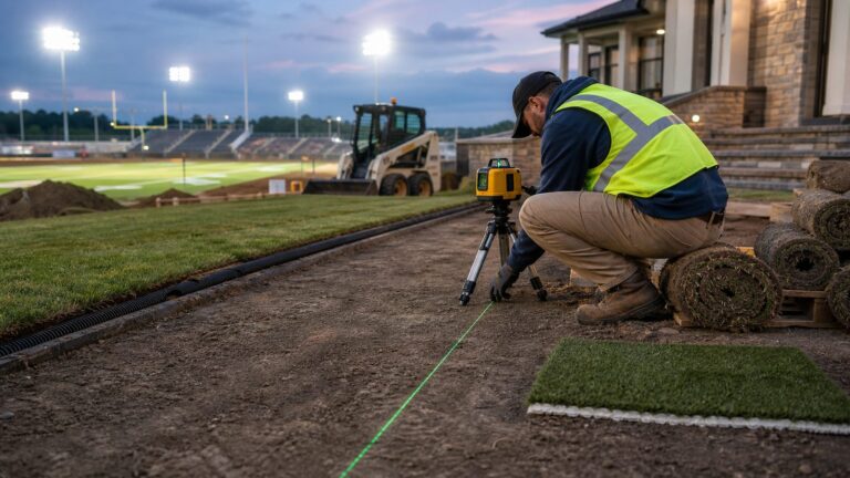
For development projects, the team captures site conditions and infrastructure installation. It processes the imagery into high-resolution images, orthomosaics, and 3D models, then brings the resulting information into GIS. Staff can compare current site conditions with engineering plans and as-built drawings, while construction inspectors, engineering, wastewater collections, and leadership can review shared data.
The workflow is intended to help teams see what is happening across a site and catch installation issues while they can still be addressed. GIS Manager Jonathan Denton described the aim this way: “We have a team of two inspectors and sometimes they don’t catch everything. If we can help them capture something that may go missed before it gets covered up, we’d like to help with that,”
The Tool Desk
Outbyte Driver Updater FREEScan for outdated or missing drivers - takes under a minuteDriver Scan →Outbyte PC Repair FREERepair Windows errors before they cause bigger problemsFix Now →#1 Best Overall
Where drone imagery supports construction oversight
Checking installations against plans
The Esri account describes staff using aerial imagery to review active construction and compare work with plans and as-builts. Reported examples include magnetic tracer tape placed incorrectly, pipe spacers missing beneath road crossings, and improperly installed manhole lids. These are the kinds of details that can be difficult to verify once work is covered or a site has changed.
Site Scan can publish 2D and 3D products for simultaneous stakeholder review. Esri says this supports collaboration and faster review cycles, although the case study does not quantify how much time reviews save.
Rank #2
Building safety awareness
In one reported example, imagery showed workers in a 17-foot-deep trench without proper trench boxes, enabling staff to address the hazard. The case study also says the district uses drones to inspect elevated storage tanks before personnel climb the structures. These uses provide additional visual information; the account does not establish that drone imagery replaces required site inspections or safety procedures.
Supporting earthwork and wastewater planning
At a pressure-reducing valve vault project, drone-derived elevation data supported cut-and-fill analysis and estimates of aggregate and backfill requirements. In Gunter, elevation information helped staff validate manhole locations, analyze wastewater flow paths, and plan future gravity mains, force mains, and lift stations.
Quick wins for a faster PC:
Scan for outdated or missing drivers - takes under a minuteDriver Scan →Repair Windows errors before they cause bigger problemsFix Now →Fix the driver behind crashes, sound loss and screen glitchesFind Drivers →Rank #3

- HIGH VISIBILITY GCP TARGETS: Black and white checkerboard markers help create clear reference points for UAV mapping, aerial survey and photogrammetry field work
- 24 IN SURVEY FORMAT: Each marker measures 24 x 24 in, giving field teams a consistent visual target for topographic surveys, volume checks and site mapping
- OXFORD CLOTH BUILD: Flexible Oxford cloth folds for transport and resists water during repeated outdoor deployment
- 4 CORNER HOLE SETUP: Pre-punched corner holes let crews stake each marker flat on grass, dirt, gravel or hard pavement to reduce movement in windy conditions
- 10 PACK FIELD KIT: Numbered markers support coordinate matching for survey companies, civil engineering teams, construction contractors and UAV operators
GIS Manager Jonathan Denton said the program’s impact has been “The ability to capture data at a more detailed and efficient level for making decisions.” The case study presents these examples as district-reported applications, not as independently evaluated project outcomes.
Thermal imagery: current use and a potential customer application
Mustang SUD currently uses thermal imagery to investigate water loss and potential leaks, according to Esri. Using thermal imagery for customer high-bill applications is still under exploration; it should not be confused with a service the district says it has already deployed.
Rank #4

- Standard Kit Includes - 20 Aerial Targets, 20 adhesive-backed center markers, 20 60D adapters, 1 field carrying case.
- Size & Accuracy – 12" diameter surface with 2.5" adhesive-backed center marker.
- Color – Black with white cross targets with a bold black adhesive center marker ensure fast, precise center identification in aerial data and during ground survey, delivering reliable accuracy across mapping and survey workflows.
- Precision & Speed – Engineered for survey-grade accuracy, DronePoints install in seconds with a single nail or spike, saving time compared to bulky legacy PVC targets.
- Dual-Use Flexibility – Built-in stencil feature lets you mark asphalt or concrete instantly with spray paint.
How drone imagery fits the district’s broader GIS work
A separate account published by Eos Positioning Systems and authored by Mustang SUD Public Relations Manager Stephanie Bernard describes related field-mapping operations. Crews use ArcGIS Field Maps with Eos Arrow GNSS receivers to map valves, maintenance holes, and water and wastewater lines. The account also mentions Experience Builder, Dashboards, and Arcade in internal operational maps. It describes the district’s broader GIS context, not tools identified as part of the drone-imagery workflow. Read the Eos account.
Mustang SUD’s FY 25–26 organizational chart places GIS, Engineering, Project Management, and Construction within Engineering & Development. That structure offers context for how spatial information can be shared across functions, but the chart does not describe the drone program’s operating procedures.
Best Value

- Enhanced Field Coordination: These UAV aerial drone center eyelets numbered survey markers enable effortless identification and precise coordinate tracking, streamlining your operations in the field. Easily locate and reference specific points during mapping missions.
- Optimal Visibility: The black/white color scheme in these uav drone aerial targets is specifically designed to ensure excellent target visibility even in bright and challenging lighting conditions. Maintain clear visual reference points for accurate data collection.
- Secure Ground Placement: Equipped with four corner eyelets, these drone target center points can be conveniently fixed to the ground. This feature guarantees stability during data capture, providing consistent and reliable results.
- Lightweight Durability: Crafted from a lightweight yet durable material, this high point ground marker offers long-lasting performance in demanding environments. Its robust construction ensures resistance to wear and tear, making it a reliable companion for your mapping and surveying endeavors.
- WORKS WITH LEADING PHOTOGRAMMETRY SOFTWARE - Pix4D, DroneDeploy, Metashape, OpenDroneMap/WebODM, UAV4GEO Lightning, DJI Terra, Esri Drone2Map, Bentley ContextCapture, SimActive Correlator3D, 3Dsurvey, Propeller, Global Mapper Pro & RealityCapture
What the reported benefits do—and do not—show
Esri’s case study reports better visibility into active construction, faster access to current high-resolution imagery, improved plan and as-built validation, stronger collaboration, identification of hazards and construction issues, and more efficient elevation and asset-data collection. These are qualitative benefits reported by the district through Esri. The account explicitly says Mustang SUD is not formally tracking performance metrics, so it does not establish quantified savings in time or cost, or a measured reduction in safety incidents.
Applications the district is still exploring
The case study identifies several possible future applications, rather than capabilities it says are already in operation:
- Automated drone deployment
- AI-assisted inspections
- Expanded thermal-imaging applications
- Confined-space inspections
- Atmospheric gas monitoring
- Underwater drones for storage-tank inspections
GIS Analyst Liliana Ruelas described Site Scan as “a easily digestible entrance into GIS” for colleagues new to the technology, noting that 3D visualization can help departments focus on what to do with information rather than first verifying measurements or asset locations.
What this case offers other construction and utility teams
Mustang SUD’s account illustrates one in-house model: licensed operators capture imagery, a GIS department processes and organizes it, and multiple teams review shared products for construction, safety-awareness, and planning tasks. For organizations assessing a similar approach, the useful questions are practical:
Free tools Windows power users keep installed
One-click scans. No signup required.
- Who will operate the aircraft and maintain the required licenses and training?
- How will imagery be processed, stored, and connected to plans, as-builts, and GIS layers?
- Which decisions need 2D imagery, 3D models, or elevation data?
- Which construction or field problems are suitable for aerial review, and which still require an on-site inspection?
- How will the organization measure whether the workflow improves review time, data quality, cost, or safety outcomes?
The district’s GIS manager recommends beginning with a solvable need: “Start with a small problem you can solve practically, then scale out to all of the possibilities,“ said Denton. “The efficiency in field data collection is the champion, especially when you’re collecting data across huge areas.”
Quick Recap
Product prices and availability are accurate as of the date/time indicated and are subject to change. Any price and availability information displayed on Amazon at the time of purchase will apply.