Before buying land in Elko County, verify that your exact project is allowed on the parcel and that you can secure lawful access, water, wastewater approval, and a usable building site. A parcel number, listing description, zoning label, or nearby well does not prove that a particular home or construction plan can be built. Make your offer contingent on enough time to obtain written agency answers and qualified title, survey, and site reviews.
1. Identify the parcel and review its recorded history
Start with the parcel’s assessor parcel number (APN) and legal description. Search the Elko County Recorder’s Landmark system by parcel identifier, legal description, and recorded documents. Review deeds and recorded easements, paying particular attention to whether an easement provides a route to a public road.
The Landmark portal says Elko County makes no warranty or guarantee about the accuracy or reliability of its content. Treat the records portal as a starting point, not a title opinion or proof that a boundary or access route is where it appears on a map. Have a title professional review title exceptions, and hire a Nevada-licensed surveyor if you need boundary lines located or discrepancies resolved between the legal description, maps, fences, and apparent access.
2. Get a parcel-specific zoning and permit answer
Elko County’s unincorporated territory outside incorporated cities and Indian reservation lands is divided into zoning districts, and permitted and restricted uses vary by district. Do not rely on a seller’s description of land as “residential” or “buildable” to establish that your specific plan is allowed.
Free tools Windows power users keep installed
One-click scans. No signup required.
#1 Best Overall

- Large Screen:Large 3.2" sunlight-readable color display with 240 x 320 display pixels for improved readability,even in bright sunlight
- Professinal Accuracy: Supports 6 satellite systems (GPS, Beidou, Galileo,GLONASS, NAVIC and QZSS ) for high presion measurement, area error < 0.002 acres,distance error < 5 ft
- 7 Measurement Modes: Supports area measurement of irregular and regular terrain such as ranches, garden; length measurement of straight and curved lines, height and slope measurement, and can also save the coordinate points of the current position (can only save coordinates, cannot be modified)
- Rugged With Long Battery Life: IP65-rated for superior durability; powered by internal 4000 mAh Li-ion rechargeable battery, up to 48 hours in continuous use
- TIPS!!!: The device needed to be held horizontal for taking measurements. Recommend to measure Area above 0.04 acres and distance above 328ft. The larger the measurement range, the smaller the error.The altitude data displayed on the device is GPS altitude, which fluctuates with changes in the satellite signals received. This is normal
Ask Planning and Zoning about your intended project
Give the County the APN or legal description and describe the actual use you are considering. Ask about:
- Whether the intended dwelling or other project is an allowed use in the parcel’s district.
- How many dwellings are permitted and what minimum lot area applies.
- Setbacks, overlays, and any conditional or special-use permit requirements.
- Building permit requirements and any subdivision or parcel-map conditions.
Use the official zoning map held by Planning and Zoning to identify the applicable district, then confirm the rules and requirements directly with the County. The online code compilation states that it is current through Ordinance 2024-04 and warns that it may not reflect later legislation, so verify current requirements before relying on it.
Rank #2

- 📏【9999.11 Maximum Capacity】– U.S. Measuring units, Measures in feet and inches. Measure distance wheel against a usual tape measure and it will be the same measurements. Whether private or industrial purposes, the measurement of straight line and curve line is easy.
- 📏【Zozen Measuring Wheel】– One key reset, Larger bracket, Redesigned joints, Threaded TPR tires, Increased friction, Original location marker, Exquisite zozen tape measure and backpack. The handle features a large for more comfort.
- 📏【Portable & Accurate】– Through 2 tims folds can be folded to 16 inches into a backpack(included) for easy carrying and transport. Unfolded it extends to 40”. Adopts a precise gear structure design with an accuracy of±0.5%. the forward count increases, and the backward count decreases, effectively avoiding errors.
- 📏【Who Uses It】– The surveying wheel is great for indoor, outdoor projects, also ideal for real estate appraisers, law enforcement, construction workers landscaping workers and homeowners to measure your boundary lines of your property. Versatile enough to use on a variety of indoor and outdoor projects, this tool is ideal for real estate appraisers, law enforcement, construction or landscaping workers and homeowners alike.
- 📏【Different Environments】 – With sturdy, durable rubber, walking roller wheel is equipped for all environments – grass, concrete, gravel, dirt and more! STURDY – Walking wheels are great for professional work projects or school activities. Extremely accurate makes it extremely useful to measure the boundary lines of your property and neighborhood.
3. Establish whether a lawful water supply is available
Do not infer water availability from acreage, a nearby well, an assessor listing, or a map layer. Ask the Nevada Division of Water Resources (NDWR) about the parcel’s basin, nearby public water supply, well and water-right records, and any applicable limitations.
Understand the limits on domestic wells
NDWR’s June 2024 domestic-well FAQ says that, generally, a domestic well cannot be drilled if the parcel can be physically and legally supplied by a public water supply. The FAQ describes domestic use as relating to a single-family dwelling and limits it to 2 acre-feet per year—about 651,700 gallons. It also says a domestic well generally cannot serve multiple homes. These limits make a domestic well an uncertain fallback, not a guaranteed supply for a planned project.
Rank #3

- HIGH PRECISION ACCURACY: 2 high sensitivity satellites global GPS + GLONASS coverage for reliable surveying around the world, support for fast positioning and a reliable signal,area measurement error in 0.003 acres,it cannot be used for saving waypoints and navigation
- LARGE LCD: Our Product has a 2.4 inch FSTN panel and equipped with LCD backlight display, the measurement results can be displayed on the screen directly, convenient for observation
- RUGGED DESIGN: Our Product has a weight of approximately 180g/6.3oz and is compact, making it easy to carry. Adopts humanized groove design, easy to hold and not easy to fall off when using
- 4 IN 1 MEASUREMENT: 2 types of area measurement methods that can measure garden parking lot ranch and flat field.2 distance measurement that can measure straight and curve line distance
- !!! PLEASE NOTE:Please search satellite signals in an open outdoor area before using this device and there is no signal can be found indoors.When the signal value in the upper left corner of the device screen is below 1 m, start measuring to ensure the accuracy of this device
NDWR’s mapped water-right places of use are based on applications and may not include all water-right information. A map therefore does not establish that a right is owned, available, or transferable. If you plan to drill, Nevada requires a licensed well driller.
4. Confirm wastewater and septic feasibility separately
Do not assume a septic system is approved or will fit on the parcel. Nevada’s domestic-well FAQ says septic tank concentration and well separation must comply with local or state health laws. The Nevada well guide says domestic wells on parcels under one acre require approval from the Nevada Division of Public and Behavioral Health to ensure sufficient separation from septic systems.
Rank #4

- DURABLE MATERIAL: KEZERS 32x transit level kit with tripod are well-made with all-metal body,while maintaining IP54 protection,it has good weather resistance and durability.The magnetic damping system quickly stabilizes the system and reduces the effects of site vibration.
- SELF-LEVELING: The internal magnetic damping system is used in the automatic optical level, and the generated magnetic field force is always stable, which can quickly stabilize the system, reduce the influence of working vibration, and protect the pendulum from damage during transportation.
- PROFESSIONAL LEVEL TOOL: KL-32X automatic optical level featuring a powerful 32X magnification lens and 36mm large aperture,these makes you can easily working with it within a range of 393Ft.The machine offers excellent accuracy of 1/16" at 100Ft with a standard deviation of 1.0 mm per kilometer (double run leveling).
- EASY TO SET UP ALIGNMENT: Optical levels provide horizontal and vertical cross-hairs and lines of sight to measure level and alignment and estimate distance. At the same time, the round bubble bottle with 90 degree prism allows for easy and quick setup and alignment.
- PACKAGE AND WIDE APPLICATIONS: You will get a complete optical leveling kit including 1 x KL-32X Automatic Optical Level,1x 9FT Aluminum Grade Rod — Dual-sided graduations (Inches/Feet) for easy reading,1x Heavy-Duty Aluminum Tripod — Stable support with quick-release clamps,1x Hard Shell Carrying Case — Shockproof protection for easy transport. Ideal for Foundation Leveling,Deck Building,Grading, Construction,Landscaping, Irrigation, and other professional engineering and surveying tasks.
Ask the relevant health authority what site or soil evaluation, setbacks, reserve area, and approvals apply to this APN. Get the requirements for the particular parcel rather than relying on a nearby property’s system or a seller’s assurance.
Independent reader supportYour contribution helps us test, update, and keep practical guides available for everyone.5. Check flooding, runoff, and the buildable area
Elko County’s floodplain district provisions identify areas where flooding may be expected, including stream floodplains and cloudburst runoff plains. The County may require a use permit and evidence that flooding or free-flowing runoff will not impair development. Supporting information described in the code can include topography and grading, proposed structures and finished-floor elevations, and underground utilities.
Best Value
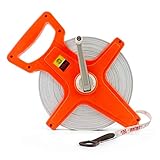
- High Quality - Made of premium fiberglass, this tape measure is soft, durable, water resistant.
- Ergonomic Handle - With our ergonomic handle, you can grip this tape for a long time working and will not feel tired.
- Double Side - Our 100M /330 FT tape measure can be double used. One side is inches/feet, another side is metric. The width of this tape measure is 1/2 ".
- Fast Rewinding - With a pivot hand reel on the side of the cover, it can organize the tape measure quickly and will not hurt your hand.
Check current official flood-zone mapping, then ask the County what review or studies apply to the parcel and proposed work. Have a qualified professional assess drainage, slope, erosion, and the land area that can actually accommodate the project. A large parcel can still have a limited usable building envelope.
6. Verify legal access and construction practicality
Confirm a recorded legal route from a public road to the parcel. Find out who maintains it, whether any easement is wide and usable enough for construction and emergency access, and whether a crossing of public right-of-way requires a permit. A parcel map or GIS layer does not establish recorded access rights or guarantee that a route is practical.
Walk the route in relevant seasons if conditions may change with weather. Elko County has right-of-way permit procedures, but the available County procedure document is dated 2005; confirm current requirements directly with the County before planning work that affects a public right-of-way.
7. Price infrastructure before comparing purchase prices
Ask providers and contractors for written availability information and cost estimates for power, communications, road improvements, water connection or well, wastewater, grading, and fire or emergency access. A line on a map or a nearby service does not establish that a connection is available at the parcel or what extending service will cost.
The Tool Desk
Outbyte PC Repair FREEClear out junk files and repair common Windows errorsFree Scan →Outbyte Driver Updater FREEFix the driver behind crashes, sound loss and screen glitchesFind Drivers →Compare candidate parcels on the certainty of permitted use, title and boundary information, legal access, lawful water supply, wastewater path, usable building area, and the cost and schedule for infrastructure—not purchase price alone. Build time for agency responses and professional reviews into your due-diligence deadlines, and make the purchase contingent on resolving the issues that matter to your plan.
Quick Recap
Product prices and availability are accurate as of the date/time indicated and are subject to change. Any price and availability information displayed on Amazon at the time of purchase will apply.