As of October 7, 2026, completion and public access to the Upper Falls Connector Trail could not be confirmed. The latest dated report, from WNCW on October 1, said boardwalk construction was underway and that The Pisgah Conservancy expected work to wrap in early October. That projected finish is not confirmation that construction ended or the trail opened.
What is the Upper Falls Connector Trail?
The planned 0.9-mile route will connect the John Rock Overlook parking area off the Blue Ridge Parkway with the valley floor at Graveyard Fields. The Pisgah Conservancy describes it as an alternative way into the area, intended to disperse hikers, improve emergency-service access, and support restoration work that existing routes cannot accommodate. The Pisgah Conservancy project page continues to label the project “In-Progress.”


As an Amazon Associate I earn from qualifying purchases.
Is the trail open now?
The available dated updates do not establish that the connector is complete or open to the public as of October 7. WNCW reported on October 1 that boardwalk work was underway and quoted an expectation that construction would wrap in early October. An expected finish date is not an opening announcement. The Forest Service alert shows a projected mid-September construction conclusion, but that timeline conflicts with the later October 1 field update and should not be treated as proof of completion. Check with The Pisgah Conservancy or the Forest Service alert page for current status before planning to use the connector.
Do these 3 things before closing this tab:
1Fix the driver behind crashes, sound loss and screen glitches2Clear out junk files and repair common Windows errors3Scan for outdated or missing drivers - takes under a minuteWhy is a new trail being built?
The connector is part of broader Graveyard Fields restoration planning. The Conservancy says existing paths include stairs, narrow corridors, bridges, and other infrastructure that cannot carry the equipment and materials needed for upcoming repair and restoration work. The new route is being built to provide more durable access for that work, as well as pedestrian recreation.
#1 Best Overall
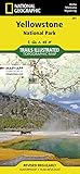
- Waterproof. Tear-resistant. Regularly revised.
- UTM grid is printed on the map to aid with GPS navigation. Over 1,000 miles of mapped trails. Includes mileages between intersections.
- Provides elevation, duration, and difficulty of trails. Map base includes contour lines, elevations for summits, passes and lakes. Features campgrounds, trailheads, boat ramps, marinas, scenic overlooks and interpretive trails.
- Features key points of interest including Mammoth Hot Springs, Canyon Village, Yellowstone Lake, Yellowstone Falls, Grant Village, and Old Faithful geyser area. .
That access could support trail repairs, storm recovery, streambank work, and red spruce habitat restoration. It is also intended to improve emergency access and disperse visitors. The Conservancy’s Chief Operating Officer and Program Director, Jeff Maitz, called the project “a linchpin of the Graveyard Fields project at large.”
Independent reader supportYour contribution helps us test, update, and keep practical guides available for everyone.How construction has progressed
- May 2026: Construction began on May 19, according to a June project announcement from The Pisgah Conservancy.
- July 22, 2026: The Conservancy reported that much of the corridor had been cleared and benched, with geotextile fabric and compacted aggregate surfacing being installed. Bridges, fords, and finish work remained.
- August 2026: Aggregate surfacing had been laid and compacted on more than half the route. The Conservancy said fords, bridges, and boardwalks would follow.
- October 1, 2026: WNCW reported boardwalk construction underway and an expected early-October wrap-up. No later confirmation of completion or public opening is established here.
Sources: project page, July update, August update, and WNCW’s October 1 report.
Quick Recap
Best Value

- Trails Illustrated Map: Acadia National Park
- Trails Illustrated Map: Acadia National Park
- National Geographic Maps
Rank #3
Rank #2

- National Geographic Map - Great Smokey Mountain National Park
Product prices and availability are accurate as of the date/time indicated and are subject to change. Any price and availability information displayed on Amazon at the time of purchase will apply.
Recommended Free Tools




