Free tools Windows power users keep installed
One-click scans. No signup required.
Choose a reality-capture platform by starting with the facility decision it must support, not with a scanner, app, or “digital twin” label. Define the users and tasks, set the accuracy and update interval those tasks require, then test the complete path from capture and point-cloud preparation through asset information, validation, exports, and handoff to your CMMS, IWMS, BAS, or BIM environment. A platform is suitable only when it produces information that your operations team can find, trust, and keep current.
What a reality-capture platform must deliver in facility management
Reality capture turns existing physical conditions into usable digital information. Depending on the method, the input can include laser scans, photographs, 360-degree imagery, mobile scans, survey control, or other spatial observations. Facility management (FM) value appears only after those observations are registered, cleaned, modeled or enriched, checked, and connected to the systems and decisions used by the organization.
As an Amazon Associate I earn from qualifying purchases.
Typical outcomes include locating an asset before a maintenance visit, confirming whether equipment exists where records say it does, planning a space change, coordinating a renovation in an occupied building, or viewing facility information in a digital-twin environment. The right platform for one outcome may be a poor choice for another. A survey-grade record of a small plant room, for example, has different requirements from a frequently refreshed visual index of a large office portfolio.
The Digital Twin Consortium’s reality-capture guidance treats the use case as the starting point: the use case determines the necessary accuracy, capture frequency, and device. Its related digital-twin guidance describes asset tagging and display as a practical use of reality-capture data. Those principles are more reliable than choosing software because it advertises a particular device or uses the term “digital twin.”
#1 Best Overall
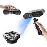
- 【Industrial-Grade Accuracy】Achieve single-frame accuracy up to 0.03 mm and volumetric accuracy of 0.03 mm + 0.05 mm x L(m), faithfully reproducing the finest surface details and complex geometries with exceptional consistency. Full-Field Structured Light accuracy reaches 0.08 mm; VCSEL mode delivers 0.10 mm @ 300-500 mm and 0.20 mm @ 500-800 mm. Engineered to meet the demanding requirements of 3D printing, reverse engineering, and precision modeling applications.
- 【Ultra-Fast Scanning & Robust Frame Rate】Multi-line Laser mode delivers up to 105 fps with NVIDIA GPU acceleration. Full-Field Structured Light mode achieves up to 5,000,000 points/s. The high frame rate ensures a smooth, uninterrupted scanning experience, especially suited for rapidly capturing large objects and complex scenes, significantly boosting overall workflow efficiency.
- 【AI-Powered & Photo-Grade Retopology】 AI object segmentation (Windows only) identifies your target in one click, tracks it throughout the scan, and auto-filters background noise — delivering clean data and streamlining post-processing. The patented 3D Gaussian Splatting converts point cloud and RGB data into true-to-life 1:1 photorealistic models; import photos from your phone or camera to apply real textures, then export in splat format for gaming, animation, and VR.
- 【All-Weather Outdoor Scanning】Multi-line Laser mode operates reliably up to 50,000 lux; with an outdoor filter attached, scanning remains stable in lighting conditions of up to 100,000 lux; VCSEL mode operates reliably in up to 100,000 lux ambient light. Designed to overcome lighting challenges, it provides consistent all-weather performance for construction sites, archaeological digs, and industrial fieldwork.
- 【5 Scanning Modes】NIR band supports Full-Field HD Scanning (markerless, fine structured light), Hybrid HD Scanning (dual projectors, fast high-quality modeling), and VCSEL Rapid Scanning (high-density pattern, fast markerless capture). Blue light band supports 30-Cross Laser Lines Scanning (handles high-reflectivity metals & dark objects) and Single-Line Deep Hole Scanning (captures from deep holes & narrow grooves). Five modes for comprehensive indoor and outdoor coverage.
1. Define the operational job before comparing platforms
Write a one-sentence job statement that names the users, the facility area, the decision, and the acceptable evidence. “Maintenance technicians need to find isolation valves in Building A and verify the asset record before work orders are dispatched” is actionable. “Create a digital twin” is not.
| Operational job | Primary users | Information that must be delivered | Questions to resolve |
|---|---|---|---|
| Document existing conditions | Owners, designers, project managers | Registered spatial data, photographs, control information, and a defined level of geometric detail | Is the record for a legal survey, design coordination, estimating, or general reference? |
| Verify and locate assets | Maintenance, reliability, compliance teams | Stable asset identifiers, location, photographs or other existence evidence, and required attributes | Which asset classes matter first, and what proof is required before an asset is accepted? |
| Support maintenance and space planning | FM planners, space managers, contractors | Searchable rooms and equipment, dimensions, access constraints, and links to work or occupancy records | Which decisions will change when the information is available? |
| Coordinate renovation or capital work | Capital-project teams, consultants, operations | Current geometry, known deviations, model files, issue tracking, and controlled handover data | What tolerances and model detail are required for the next design or construction stage? |
| Connect facility information to operational systems | FM administrators, controls engineers, IT | Validated identifiers and attributes that can be exchanged with CMMS, IWMS, BAS, BIM, or analytics tools | Which system owns each field, and how will changes flow in both directions? |
Rank jobs as primary, secondary, or out of scope for the first deployment. Ask each stakeholder to identify a decision that is currently delayed, unsafe, expensive, or dependent on a person’s memory. This prevents a platform demonstration from being judged on attractive visualization instead of operational usefulness.
2. Set accuracy, coverage, and update requirements
Accuracy should follow the consequence of error
Do not specify survey-grade capture by default. A few millimetres may be necessary for a fabrication interface or tightly coordinated retrofit, while a room-level visual reference may need considerably less. State the tolerance, the coordinate reference, the areas included, and how accuracy will be verified. If an error could cause a shutdown, rework, safety risk, or failed approval, define a stricter acceptance test than you would for a searchable visual index.
Recommended Free Tools
The Digital Twin Consortium associates terrestrial laser scanning with use cases requiring survey-grade accuracy in appropriate static spaces. That identifies a hardware category, not a universally correct instrument or platform. Your specification still needs control points, registration tolerances, occlusion handling, and a verification method.
Coverage is more than floor area
- List buildings, floors, rooms, roofs, plant areas, service voids, and external assets included in the first release.
- Identify inaccessible, hazardous, occupied, reflective, dark, or rapidly changing areas that may require a different capture method or a separate visit.
- Define whether deliverables include raw observations, registered point clouds, photographs, a federated model, asset records, or all of these.
- Record exclusions explicitly so users do not mistake an absent asset for a verified absence.
Choose an update cadence that matches change
Capture frequency should reflect how quickly the facility changes and how costly stale information is. A one-time baseline may be adequate for a stable archive. Active construction, frequent churn, or high-risk equipment may require updates after defined milestones or on a recurring schedule. Require the platform to show capture date, processing date, validation status, and the responsible party so users can judge whether information is current.
3. Evaluate the complete capture-to-FM workflow
A March 30, 2026 study of scan-to-BIM for educational facilities describes five stages: capture planning, field capture, point-cloud preparation, BIM modeling and validation, and FM deliverables. It examined one occupied undergraduate laboratory and one scanning method, so use the stages as a practical workflow model rather than as a universal production standard.
Stage 1: Capture planning
- Define the job statement, accuracy, coverage, coordinate system, naming rules, safety controls, and access windows.
- Plan scan positions, photographic views, control points, registration targets, and areas likely to be occluded.
- Decide which observations are needed for geometry, asset identity, condition, serial numbers, labels, and operational attributes.
- Assign an owner for the capture plan and a person authorized to approve deviations in the field.
A platform should let the team preserve the plan and associate field observations with locations or assets. If planning remains in disconnected spreadsheets with no traceable link to delivered data, later validation and update work becomes harder.
Rank #2
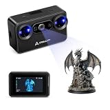
- Pocket-Sized & Wireless Freedom: At only 260g and 1006035mm, Pika fits in your palm. Features Wi-Fi 6 wireless PC mode, 3-inch HD touchscreen (500 nit), dual swappable 3350mAh batteries for extended sessions, and supports outdoor scanning up to 110,000 lux - scan anywhere, anytime without cables
- Dual-Mode Scanning with Blue Laser & NIR Structured Light: Switch between 7-line blue laser mode for fine detail capture and NIR structured light mode for full-body scanning with 24-bit true color. Scan objects from 101010mm to 200020002000mm - from tiny miniatures to life-size body scans - all with one device
- Ultra-High Precision 0.03mm Accuracy: Equipped with 7 parallel blue laser lines, Creality Pika delivers up to 0.03mm scanning accuracy and 0.1mm 3D resolution, capturing intricate details on small parts, figurines, mechanical components, and collectibles with professional-grade precision for 3D printing and reverse engineering
- AI-Powered Smart Features: Built-in AI Body Completion generates full-body 3D models from just a face scan and photos in as little as 10 seconds (10 faster). AI Retexturing maps real photo textures onto scanned models for lifelike results. AI Hole Filling automatically repairs incomplete scans for cleaner, print-ready output
- Scan Black & Metal Without Spray and Multi-Platform Export: Directly scans dark and metallic surfaces without scanning spray. Exports STL/OBJ/PLY/ASC formats compatible with all major 3D printing and CAD software. Works with Windows, macOS, iOS, and Android via CrealityScan app. Includes tripod, turntable, calibration board, and full accessories
Stage 2: Field capture
Compare supported inputs rather than counting device types. Ask whether the platform accepts the sensors you already operate, whether it preserves original files and metadata, and how it handles repeat visits. Check field usability in the actual building: offline operation, battery and storage demands, target placement, safety restrictions, user permissions, and the time required to confirm that a room is complete.
Require a field-completeness check before the crew leaves. Missing ceiling spaces, blocked equipment labels, or an unrecorded coordinate-control problem can be more expensive to fix than a platform subscription.
Stage 3: Point-cloud preparation
Ask who registers scans, removes noise, applies control, manages coordinate systems, and creates shareable derivatives. Establish processing tolerances and a naming convention for scans, regions, levels, and revisions. Large datasets should have a documented method for tiling, streaming, permissioning, and archival without silently reducing the information needed for later work.
Request a sample project using your own facility data. A marketing demonstration with a small, clean dataset cannot show how the platform behaves with reflective surfaces, repetitive corridors, moving occupants, multiple floors, or disconnected survey control.
Stage 4: Modeling, enrichment, and validation
Decide whether the deliverable is a point cloud, an as-built model, an asset information model, or a combination. Define the level of geometric detail and the semantic attributes by asset class. Validation should compare the result with field evidence and agreed tolerances, not merely confirm that a model file opens.
Test how the platform records issues, assigns corrections, preserves revision history, and distinguishes measured facts from assumptions. Require reviewers to see the source evidence for an asset and to know who approved its status.
Stage 5: FM deliverables and handoff
Specify the final package for each consuming system: file formats, coordinate reference, identifiers, required attributes, photographs, links, permissions, and update procedure. The handoff is complete only when an FM user can find a representative asset, verify its evidence, and use the identifier in the target workflow.
Rank #3

- Wireless Scanning & Interactive Streaming: Built-in WiFi 6.0 enables on-the-go, structured light mobile scanning or real-time PC-to-mobile interactive scan streaming for seamless remote operations and more flexibility.
- Scan Challenging Surfaces Without Scanning Spray: Easily capture details on reflective or dark surfaces with 11 infrared laser lines, no scanning spray needed.
- Dual Scanning Modules: Boost scanning efficiency with INSPIRE 2's infrared structured light and multi-line laser scanning modes, making it easy to handle different materials, sizes, and environments.
- Accurate Models & Advanced Calibration: Create highly detailed models with an accuracy of up to 0.05 mm and precision of up to 0.03 mm. A high-precision calibration board boosts point cloud accuracy by 75%, ensuring consistent, precise data for 3D printing, reverse engineering, and detailed modeling.
- Outdoor Scans & Lightweight Design: Scan in outdoor environments with up to 20,000 lux lighting, ensuring reliable performance in shaded or semi-bright conditions. At only 190g, the INSPIRE 2 is lightweight, and its aerospace-grade aluminum alloy front panel offers increased durability and portability.
4. Make asset information usable and governable
Geometry alone rarely answers an FM question. Before fieldwork, agree an asset information standard with the owner and operations representatives. The standard should define which objects count as assets, how they are named, which fields are mandatory, acceptable values, units, evidence requirements, and who owns corrections.
Minimum asset-information decisions
- Identifier: one stable key that can be recognized in the capture platform and the operational system.
- Classification: an agreed equipment or space class, not an improvised label from each surveyor.
- Location: building, level, room or zone, and coordinates or a spatial reference appropriate to the use case.
- Attributes: only fields that a named process will use, such as manufacturer, capacity, service interval, or safety status.
- Evidence: a photograph, label image, scan region, drawing reference, or other proof of existence and identity.
- Lifecycle status: planned, installed, in service, removed, inaccessible, or requiring review.
- Ownership: the role responsible for approving new records and correcting stale ones.
A vendor-authored case published by Production Modeling Corporation on March 12, 2026 describes owner-aligned standards, photo verification of asset existence, and normalization of an Asset Information Model. Those practices are sensible governance patterns, but the case is vendor-authored and should not be treated as independent proof of performance.
Prevent “model first, data later” failure
Do not accept a visually impressive model with invented or empty attributes. Start with a small asset class and make the team demonstrate the complete record: select the object, see its identifier and required fields, open the evidence, and follow the link into the operational system. Expand only after that path works consistently.
5. Test interoperability with your real systems
Compatibility badges and generic import lists are not enough. Build an integration test around representative assets and the systems your facility actually uses. Include at least one asset with a long identifier, one with a missing attribute, one that has moved, and one that must be retired.
Systems and handoff questions
- CMMS: Can the asset key, location, class, and evidence link be used in a work order without manual retyping?
- IWMS or space system: Are rooms, zones, areas, and occupancy attributes exported with the required hierarchy and units?
- BAS or analytics: Can equipment identifiers be matched to points and trends without creating duplicate identities?
- BIM tools: Are model objects, coordinates, properties, and revisions preserved in the formats your designers and contractors require?
- Identity and access: Can contractors, technicians, viewers, and administrators receive different permissions, including on mobile devices?
- Change management: What happens when an asset is replaced, a room is renamed, or a model is superseded?
An Autodesk University example describes a workflow joining ReCap survey data, Revit and Civil 3D scan-to-BIM work, Tandem, SkySpark, and a CMMS. It demonstrates one described integration, not universal connector coverage. Reproduce the test with your own identifiers, field names, permissions, and approval rules before treating any connector as production-ready.
The Tool Desk
Outbyte PC Repair FREERepair Windows errors before they cause bigger problemsFix Now →Outbyte Driver Updater FREEFix the driver behind crashes, sound loss and screen glitchesFind Drivers →Use a round-trip test
- Capture or select one representative facility asset and assign the agreed identifier.
- Enrich it with the minimum required attributes and evidence.
- Export or synchronize it to the target CMMS, IWMS, BAS, or BIM tool.
- Change one field in the system of record and document where the change is reflected.
- Retire or relocate the asset and verify that history, links, and permissions remain correct.
- Measure manual steps, failed fields, duplicate records, latency, and the effort required to correct an error.
6. Compare platforms on capability, responsibility, and lifecycle effort
Use a weighted scorecard based on your job statement. A platform that wins on visualization but fails on identifiers, validation, or update ownership should not rank first for FM.
| Evaluation axis | Evidence to request | Acceptance question |
|---|---|---|
| Accuracy and capture frequency | Specification, control workflow, sample verification report, repeat-capture process | Can the supplier demonstrate the tolerance and cadence required for this facility? |
| Capture inputs and point-cloud handling | Supported formats, registration tools, coordinate controls, large-dataset behavior | Will our existing or planned capture method work without an unplanned conversion chain? |
| Asset metadata and validation | Schema controls, required fields, evidence links, issue and approval history | Can an operations reviewer prove that a record is correct and correct it safely? |
| Interoperability | Exports, APIs or connectors, field mapping, round-trip test results | Does the actual target system receive the identifiers and attributes we need? |
| Field and user experience | Offline behavior, mobile workflow, search, accessibility, permissions | Can a technician complete the common task in the actual building? |
| Governance and updates | Revision history, ownership model, audit trail, change notifications | Who keeps the information current after the initial project closes? |
| Scale and maintainability | Project-specific load test, storage and sharing design, administration effort | Does performance remain acceptable at our building, portfolio, and user scale? |
| Implementation and lifecycle cost | Capture labor, processing, modeling, licenses, storage, integration, training, support, refreshes | What recurring work is required to preserve an as-operated record? |
No neutral comparative evidence establishes that one platform performs best at every scale. Require a project-specific demonstration with written acceptance criteria instead of relying on a product name or a “digital twin” claim.
Rank #4

- Industrial-Grade Accuracy: Flawlessly capture intricate geometric details with up to a 0.01 mm single-frame precision and 0.015 + 0.04 mm x L (m) volumetric accuracy. Powered by advanced blue laser technology, the MetroY Ultra produces 3D is ideal for tight tolerance measurement, reverse engineering, and industrial inspection.
- 5 Versatile Scanning Modes: Handle every scenario, from small parts to medium-sized objects, with Metro Ultra's 5 scanning modes: 34 laser cross-lines for rapid scans, 15 parallel lines for fine details, a single-line mode for deep holes, full-field blue structured light for marker-free scans, and one-click automatic turntable scanning.
- Ultra-Fast 90 FPS Scanning Speed: Get scans done fast at up to 90 fps (NVIDIA GPU) or 60 fps (CPU). MetroY Ultra's 34-laser cross-line mode enables quick, large-area scans, reducing data acquisition time and boosting productivity without compromising data quality.
- No-Spray Scanning for Dark or Shiny Surfaces: Scan black, high-gloss, and metallic industrial components directly without scanning spray. Protect delicate parts from spray, save prep time, and keep a clean, professional inspection environment for sensitive equipment.
- Scan Outdoors: Capture industrial parts even in harsh sunlight up to 100,000 lux with MetroY Ultra's powerful laser-scanning modes.
7. Assign responsibilities before signing
Reality-capture programs fail quietly when everyone assumes someone else will maintain the result. Put the following responsibilities in the statement of work or operating procedure:
- Who schedules access and approves the capture plan.
- Who performs field capture and records exceptions.
- Who registers and prepares point clouds.
- Who models or enriches assets and applies naming rules.
- Who validates geometry, attributes, and evidence.
- Who approves the FM handoff and accepts defects.
- Who owns the identifiers and system-of-record fields.
- Who pays for storage, user access, integrations, support, and future updates.
- What event triggers a refresh: project completion, equipment replacement, room alteration, inspection, or a scheduled interval.
Separate one-time implementation effort from recurring lifecycle effort. Capture and modeling may be project-heavy, while permissions, integrations, data-quality review, and change capture continue for the life of the facility.
What’s actually slowing this PC down?
Pick the symptom - the matching free tool is one click away.
8. Run a controlled pilot with measurable acceptance criteria
Pilot a representative area rather than the easiest room. Include different asset classes, an occupied zone, a service space, reflective or occluded surfaces, and at least one operational workflow. Keep the pilot small enough to review every record.
- Select the area and use case. Name the decision the pilot must improve and the users who will perform it.
- Freeze the information standard. Approve identifiers, required fields, evidence rules, coordinate reference, and revision naming.
- Capture and process. Record field exceptions, registration results, processing time, and data volumes.
- Model or enrich only what the use case needs. Avoid paying for detail that no downstream process consumes.
- Validate independently. Check a sample of geometry, locations, attributes, and evidence against field conditions.
- Execute the round-trip integration test. Use real target-system accounts and permissions.
- Measure user completion. Have a technician, planner, and administrator perform their normal tasks without coaching.
- Record defects and ownership. Every failed field, duplicate, missing view, or stale link gets an owner and resolution date.
- Decide using the acceptance record. Scale, revise the workflow, or stop; do not expand because the visualization looks convincing.
Useful pilot acceptance criteria
- All in-scope areas have a documented capture status and date.
- Registered data meets the agreed tolerance or is clearly flagged where it does not.
- Every sampled in-scope asset has the required identifier, attributes, and evidence.
- A user can locate a representative asset and open its operational record within the agreed number of steps.
- Exports preserve identifiers, units, hierarchy, and revision information.
- Known changes can be added, approved, and traced without rebuilding the entire project.
- Access controls prevent unauthorized edits while allowing required field use.
- Storage, processing, and refresh responsibilities have named owners and documented effort.
9. Decide whether to buy hardware, software, or a service
Buy or operate capture hardware when the capability is recurring
A terrestrial 3D laser scanner is a plausible hardware category when survey-grade accuracy is required, but the scanner alone does not provide registration, asset enrichment, validation, or FM integration. Consider ownership only when you have trained operators, calibration and maintenance capacity, safe access procedures, processing resources, and enough recurring work to justify them.
Use a scan-to-BIM or reality-capture service when internal capacity is limited
Ask a service provider to state the capture method, accuracy and control procedure, model scope, asset classes, required attributes, evidence standard, validation method, export formats, coordinate reference, revision process, and operational handoff. A low survey price can become expensive if the provider delivers a model that your FM team must remap and verify.
Choose software around the operating workflow
Software is valuable when it reduces the effort to register, search, validate, share, update, and connect information. Confirm licensing for occasional viewers, contractors, field users, administrators, and integration accounts. Clarify data ownership, export rights, retention, security review, and what happens if the subscription or implementation partner changes.
Quick wins for a faster PC:
Fix the driver behind crashes, sound loss and screen glitchesFind Drivers →Repair Windows errors before they cause bigger problemsFix Now →10. Common failure modes and recovery actions
Starting with a device or brand
Symptom: The team compares scan speed or visual quality before defining an FM task. Recovery: Return to a written job statement and score each option against the resulting accuracy, cadence, asset, and integration requirements.
Best Value

- Wireless Scanning & Interactive Streaming: Built-in WiFi 6.0 enables on-the-go, structured light mobile scanning or real-time PC-to-mobile interactive scan streaming for seamless remote operations and more flexibility.
- Scan Challenging Surfaces Without Scanning Spray: Easily capture details on reflective or dark surfaces with 11 infrared laser lines, no scanning spray needed.
- 【AI-Powered & Photo-Grade Retopology】 AI object segmentation (Windows only) identifies your target in one click, tracks it throughout the scan, and auto-filters background noise — delivering clean data and streamlining post-processing. The patented 3D Gaussian Splatting converts point cloud and RGB data into true-to-life 1:1 photorealistic models; import photos from your phone or camera to apply real textures, then export in splat format for gaming, animation, and VR.
- Dual Scanning Modules: Boost scanning efficiency with INSPIRE 2's infrared structured light and multi-line laser scanning modes, making it easy to handle different materials, sizes, and environments.
- Accurate Models & Advanced Calibration: Create highly detailed models with an accuracy of up to 0.05 mm and precision of up to 0.03 mm. A high-precision calibration board boosts point cloud accuracy by 75%, ensuring consistent, precise data for 3D printing, reverse engineering, and detailed modeling.
Delivering a scan without operational data
Symptom: Users receive a large point cloud but cannot identify equipment or open a work record. Recovery: Add an asset schema, identifiers, evidence links, validation sampling, and a target-system test to the deliverable.
Accepting empty or inconsistent attributes
Symptom: Similar equipment has different names, units, or missing fields. Recovery: Publish controlled values before capture, reject incomplete records, and assign an owner for exceptions.
Ignoring occupied-building constraints
Symptom: Occlusions, moving people, restricted rooms, or safety limits create gaps. Recovery: Plan access windows, mark exclusions, schedule targeted return visits, and show completeness status to users.
PC Slower Than It Used to Be?
A free scan shows the junk files, broken settings and background clutter dragging Windows down - then fixes them in one click.Free scan · Windows 10 & 11Crashes, No Sound, or Screen Glitches?
Random freezes, missing sound and display glitches usually trace back to one bad driver. Find and replace yours safely.Free scan · under a minuteAssuming a connector proves interoperability
Symptom: A demonstration works with sample data but real identifiers fail in the CMMS, IWMS, BAS, or BIM tool. Recovery: Run the round-trip test with representative assets, permissions, field mappings, changes, and retirements.
Letting the record go stale
Symptom: The initial model is trusted even after renovations or equipment replacement. Recovery: Define refresh triggers, change ownership, revision status, and a routine quality review as part of normal FM governance.
Evidence boundaries to keep in mind
The Digital Twin Consortium provides guidance on matching use case, accuracy, frequency, and device; it does not name a universally best platform. The 2026 scan-to-BIM study provides a useful five-stage workflow but is limited to one laboratory and one scanning method. Autodesk University’s Tandem example shows a particular integration path, not general compatibility for every product. The 2026 Production Modeling Corporation case is vendor-authored. None of these sources establishes a general return-on-investment percentage, universal performance ranking, or guaranteed savings figure.
Use those sources to shape questions and acceptance tests, then make the decision from evidence produced in your own facility. The winning platform is the one that reliably turns the required observations into governed, discoverable, validated information that your operational systems and people can continue to use.
Do these 3 things before closing this tab:
1Fix the driver behind crashes, sound loss and screen glitches2Repair Windows errors before they cause bigger problems3Scan for outdated or missing drivers - takes under a minuteQuick Recap
Product prices and availability are accurate as of the date/time indicated and are subject to change. Any price and availability information displayed on Amazon at the time of purchase will apply.

