Some links on this page are affiliate links: if you buy through them we may earn a commission, at no extra cost to you.
Zillow SkyTour is an interactive 3D exterior view of a home, its lot and its immediate surroundings. It is not a live drone flight or a conventional video. On eligible listings, shoppers can manipulate a rendered scene to examine the property from multiple angles and elevations before deciding whether to arrange an in-person visit.
Zillow announced SkyTour in July 2025. It is now best understood as an established but limited-availability feature connected to Zillow Showcase listings, rather than a new tool found on every Zillow property.
As an Amazon Associate I earn from qualifying purchases.
Recommended Free Tools
What Zillow SkyTour shows
SkyTour is designed to answer exterior questions that ordinary listing photography often leaves unresolved: How does the house sit on the lot? Is the backyard connected to the deck or pool? How close are neighboring homes? Where are the driveway, street and visible open spaces in relation to the property?
On a compatible listing, the viewer can explore a home-centered aerial scene by dragging or otherwise manipulating the view. Zillow says users can move around the exterior and inspect different heights and angles. The precise button label and controls may vary by device, listing design and future product updates, so a live listing may identify the feature as “SkyTour,” “Drone Tour” or a similar aerial-view option.
Popular on Amazon

- 📷 Turn your smartphone into a 360 degree camera to create 3D virtual tours with this 3D Tour Kit. In 15 minutes (1 minute per photo) with no training, you can shoot, upload and share your 3D virtual tours anywhere online.
- Create high-quality 360 virtual tours using smartphones by taking 360-degree panoramic images. Photos are converted into tours in our iOS and Android app in 24-48 hours.
- Creating a tour starts at $59 per tour in our mobile app and includes all of the following with each tour: 3D Dollhouse to showcase the layout of your property, and image touch up to polish your tours to professional image quality, and 2d floor plan to get full dimensions. HDR photo compatibility, teaser videos, viewership analytics, and much more.
- RECOMMENDED FOR BETTER QUALITY. Asteroom Phone Cases are available for iPhone or Samsung Galaxy. These allow for the highest image quality. Mobile app compatible with 360 Ricoh V camera, Gopro, and insta 360 cameras but phones provide higher resolutions and are recommended.
- No monthly subscription. $59 per active tour. Create your first 3D tour for FREE. Find the redeem voucher in the box to activate this promotion.
A typical workflow is:
- Open a Zillow listing that supports the feature.
- Select the SkyTour or exterior-tour element.
- Drag the view to move around the property.
- Examine different elevations and viewpoints.
- Return to the listing’s photos, floor plan, disclosures and showing-request controls.
The experience complements interior photography and floor plans; it does not replace them. It also cannot substitute for an inspection, survey or visit to the property.
SkyTour versus a normal drone video
| Feature | SkyTour | Conventional drone video | Static aerial photo |
|---|---|---|---|
| Viewer control | User explores the rendered scene | None beyond play, pause or scrubbing | None beyond zooming |
| Viewpoints | Multiple captured and rendered angles | Only the angles filmed by the pilot | Usually one viewpoint |
| Best use | Understanding lot layout and exterior context | Storytelling and curb appeal | Quick orientation |
| Main limitation | Quality depends on the capture and reconstruction | An important angle may never have been filmed | Limited depth and context |
The central distinction is passive viewing versus interactive exploration. Zillow’s stated design goal is to let shoppers position the viewpoint themselves instead of watching a scripted flyover. However, “any angle” would overstate what the system provides: movement remains within the captured and rendered experience, and some viewpoints may be less reliable than others.
Windows Errors? Fix Them Before They Spread
Repair common Windows errors and clear accumulated junk for a smoother, more stable PC - no reinstall needed.Free scan · no reinstallCrashes, No Sound, or Screen Glitches?
Random freezes, missing sound and display glitches usually trace back to one bad driver. Find and replace yours safely.Free scan · under a minuteHow the 3D experience is made
SkyTour begins with structured drone imagery rather than a wholly synthetic image. Zillow describes flight plans using slow, steady orbits around the home at multiple elevations. The resulting images are processed with Structure-from-Motion reconstruction and 3D Gaussian Splatting.
Gaussian splatting represents a photographed scene with many small volumetric elements. Software uses those elements to render a navigable view as the shopper moves through the scene. Zillow says its navigation model keeps the property centered while the viewer explores it.
In practical terms, SkyTour is AI-assisted reconstruction and rendering of real drone-captured imagery. It is not a live feed, and it is not an entirely computer-generated aerial picture.
Why some views may look imperfect
Reconstruction works best when a requested viewpoint is close to imagery captured by the drone. Trees, buildings and other obstructions can reduce the quality of lower-orbit views. Zillow’s production workflow includes annotation and adjustments to the available view cone to account for those obstacles.
Do these 3 things before closing this tab:
1Fix the driver behind crashes, sound loss and screen glitches2Clear out junk files and repair common Windows errors3Scan for outdated or missing drivers - takes under a minuteShoppers may therefore notice softened, warped or distorted details around foliage, thin railings, roof edges, utility wires or moving objects. A restricted movement area is not necessarily a software failure; it may reflect the parts of the property that could be captured reliably.
Where SkyTour is available
SkyTour is not universal across Zillow. Zillow launched it on eligible Zillow Showcase listings, initially in select markets. Current Showcase booking guidance indicates that availability can depend on the market and on the media package selected.
In some markets, agents must book Zillow Media Experts and choose a package that includes SkyTour or the required aerial capture. That means three separate conditions can matter:
- The listing must qualify for Zillow Showcase.
- The feature must be supported in the relevant market.
- The required aerial media must be booked through the applicable provider and package.
Consequently, “all Showcase listings include SkyTour” and “every Zillow listing has a drone tour” are both too broad. If the option is missing, the property may be in an unsupported market, lack qualifying media, fall outside the listing’s eligibility, or have a feature that is temporarily unavailable.
The Tool Desk
Outbyte Driver Updater FREEFix the driver behind crashes, sound loss and screen glitchesFind Drivers →Outbyte PC Repair FREEClear out junk files and repair common Windows errorsFree Scan →Also popular on Amazon

- Theta V shoots hi-def smooth 360 Degree video at 30 fps at 3840 x 1920 pixels or 4K. It supports the H.264 file format for video recording ; Remote release: CA-3-compatible
- Hi-res 360 Degree spherical stills and video with improvements to the image quality. New Qualcomm Snapdragon processor has completely enhanced the exposure accuracy and white balance algorithm. Object distance- Approx. 10cm - Infinity (from front of lens)
- Theta has a 4-channel microphone that supports 360 Degree spatial audio recording built in Omnidirectional audio is recorded not just in the horizontal direction but also in the vertical direction
- The world’s-first Remote Playback capable fully spherical camera allows users to wirelessly playback 360 Degree images and videos on a large-screen display Using a compatible wireless display adapter
- Wireless LAN transfer speed (WLAN, MAX): 2.4GHz, 3mm: 20Mbps; 2.4GHz, 10mm: 10Mbps; 5GHz, 3mm: 50Mbps; 5GHz, 10mm: 10Mbps. The camera can always be connected to a smartphone using Bluetooth low energy (BLE) This function provides improvements in usability and power consumption
Does SkyTour cost buyers or sellers extra?
For home shoppers, Zillow’s cited materials do not indicate a separate charge to open or use SkyTour. It is presented as part of the listing experience.
For agents and sellers, the underlying costs are different. SkyTour is connected to Showcase and may require a Zillow Media Experts package. Zillow describes the feature as included at no additional charge for a qualifying Showcase listing when the required drone photography is booked through Zillow Media Experts. That does not mean the entire Showcase or media package is free.
There is no single nationally applicable SkyTour price in the cited materials. Zillow directs users toward local pricing based on details such as the property address and square footage. The relevant cost can therefore vary by market, property and package. Zillow’s media package information describes aerial drone photography, including multiple aerial photos, but does not establish one universal price.
What buyers can learn from SkyTour
SkyTour is most useful as a screening and orientation tool. It can help a shopper assess:
- The apparent orientation of the home on its lot.
- The shape and visible extent of yards and outdoor spaces.
- The relationship between the house, driveway and street.
- Whether a deck, pool or patio appears connected to the home.
- How close neighboring structures appear to be.
- Whether the property borders visible open land, water, a park or a busy road.
- Whether privacy, setbacks or outdoor amenities deserve closer attention.
These advantages are especially relevant for large or irregular lots, homes marketed around outdoor living, remote shoppers and buyers comparing many properties before traveling to see them.
What SkyTour cannot prove
An aerial visualization should not be treated as evidence of legal, physical or environmental facts. It cannot reliably establish:
- Exact property lines, easements or setbacks.
- Roof integrity or general property condition.
- Drainage, grading or flood risk.
- Noise levels or the real ground-level experience of a road.
- Privacy from windows, fences or neighboring yards.
- Whether vegetation is permanent, seasonal or recently changed.
- Zoning, flood-zone, HOA or permitting status.
- The precise location of neighboring structures relative to legal boundaries.
Aerial perspective can also make space appear larger or neighbors appear farther away than they feel at ground level. Important facts should be checked against disclosures, public records, a survey, an inspection and an in-person visit.
Common limitations and misleading impressions
Uncaptured or obstructed angles
Trees and structures may hide portions of the property. The system can render a smooth-looking view, but smoothness does not guarantee that every visible detail has equal photographic support.
Outdated imagery
The lawn, landscaping, vehicles, temporary structures or neighboring construction may change after the drone capture. SkyTour reflects the capture date, not necessarily the property’s condition on the day a buyer views the listing.
Restricted movement
The feature is not an unlimited virtual flight. The available navigation area may be deliberately constrained to views that Zillow considers sufficiently supported by the source imagery.
Also popular on Amazon
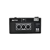
- 📷 35mm Film : suitable for 35mm negatives and slides, either colors or B&W
- 📷 3D Image : a 3D camera which carries a unique design can wiggle a still moment, giving a new life for 2D images
- 📷 Built-in Flash : enable you to photograph day and night
- 📷 Triple-Lens : a design which simultaneously captures the same object with three slightly different angles
- 📷 IOS/Android App Available : a perfect accessory to go along with our RETO3D film camera - assists you in generating videos with 3D effect. Special editing features are also added to allow awesome customised designs of 3D images!
Exterior context is not the whole decision
SkyTour is less important when a property has little visible exterior space or when the main decision factors are interior layout, structural condition and renovation quality. Strong still photography, interior tours, floor plans, disclosures and agent explanations remain necessary.
Independent reader supportYour contribution helps us test, update, and keep practical guides available for everyone.SkyTour and competing ways to view a property
Zillow 3D Home
Zillow 3D Home is primarily associated with interactive interior tours and floor plans. It can complement SkyTour: 3D Home helps explain interior flow, while SkyTour focuses on the exterior, lot and aerial context.
Matterport
Matterport is a broader spatial-capture and digital-twin platform commonly used for navigable interior tours and dollhouse-style views. Its typical strength is interior spatial understanding, whereas SkyTour is Zillow-native and focused on exterior aerial context. Current Matterport plans and capture prices should be checked directly because they can change.
Traditional drone media
A local real-estate photographer may provide aerial stills, an edited drone video, cinematic flyovers, social clips and custom shots. Those assets may be more polished or reusable across platforms. Their fundamental limitation is that a video remains passive: the viewer cannot freely choose a viewpoint that was not filmed.
Satellite and street-level mapping
Mapping services can provide broader neighborhood and road context, but imagery may be dated, may not be listing-specific and generally does not offer the same home-centered interactive view.
What SkyTour means for agents and sellers
SkyTour can make a listing easier to understand before a showing, particularly when the lot or surroundings are a meaningful selling point. It may help a property stand out within Zillow’s listing experience, but any engagement or sales-performance claims should be treated as Zillow’s marketing claims rather than independent proof that the feature causes a faster sale.
The feature also increases transparency. An aerial view may reveal close neighboring homes, utility infrastructure, a busy road, limited backyard privacy or an awkward driveway. Poorly captured or visibly distorted imagery can make a premium listing feel unfinished. Agents should therefore consider whether the exterior context genuinely supports the listing’s positioning before paying for enhanced media.
SkyTour does not eliminate the need for an accurate description, high-quality stills, interior media, floor plans, disclosures and careful guidance about what the imagery does—and does not—show. Drone operations must also be planned and conducted in compliance with applicable aviation, privacy and local requirements; Zillow’s product pages are not a complete regulatory checklist.
How shoppers should use it
- Use it to form questions, not conclusions. Note apparent privacy, access, lot orientation and outdoor connections.
- Compare it with ground-level photos. Check whether fences, trees, retaining walls and neighboring structures look consistent.
- Ask for verification. Request clarification about boundaries, easements, drainage, permits and recent changes.
- Review disclosures and public records. A rendered view cannot reveal every legal or physical condition.
- Visit before committing. Walk the lot, listen to the surroundings and inspect areas hidden by the aerial capture.
For a construction-minded buyer, the most valuable use may be identifying follow-up questions about grading, retaining walls, drainage routes, roof access, additions and outdoor structures—not assuming those issues have been inspected merely because they are visible from above.
The Bottom Line
Bottom line: Zillow SkyTour is a useful exterior-context tool, especially for homes where lot layout, privacy and outdoor features matter. It combines real structured drone imagery with 3D reconstruction to provide interactive viewpoints, but it is available only on eligible listings in supported markets and cannot replace an inspection, survey or in-person visit.
What’s actually slowing this PC down?
Pick the symptom - the matching free tool is one click away.
Quick Recap
Product prices and availability are accurate as of the date/time indicated and are subject to change. Any price and availability information displayed on Amazon at the time of purchase will apply.

