PC Slower Than It Used to Be?
A free scan shows the junk files, broken settings and background clutter dragging Windows down - then fixes them in one click.Free scan · Windows 10 & 11Outdated Drivers Are Slowing You Down
One free scan finds every outdated or missing driver and matches the right update for your exact hardware.Free scan · exact hardware matchPlan a construction delivery route as a constrained engineering and safety problem, not as a shortest-path exercise. Start with the exact truck and load, build a connected road network, encode permanent and temporary restrictions, calculate several candidates, and then inspect the entire route in the field. A route is ready for a driver only after it passes legal, physical, operational and safety checks and the responsible agencies have approved any required permits.
What a construction access route must do
A usable route must allow a particular vehicle and load to reach the site at a particular time without violating law, exceeding a structure’s limits, creating unacceptable conflicts or becoming impossible at a turn, gate or staging area. The route should also be practical for repeated deliveries: predictable travel time, enough space to queue or turn, safe interactions with people walking or cycling, and a contingency if a closure or incident blocks the primary path.
As an Amazon Associate I earn from qualifying purchases.
GIS routing produces a screening result. It does not prove that a truck can clear a bridge, negotiate a turn, pass an obstruction or enter the site. Missing bridge attributes, stale closures, unrecorded private access, temporary traffic control and poor turning geometry can invalidate an apparently efficient route.
1. Define the movement before opening a map
Every restriction is meaningful only in relation to the vehicle and movement being evaluated. Create a vehicle-and-delivery record for each truck type, trailer and load combination.
#1 Best Overall

- 【Lifetime Free Updates】 Equipped with the latest road data, this device comes with complete built-in 2026 North America maps and lifetime free map update service with no additional fees.
- 【Natural Voice Guidance & Real-Time Safety Alerts】 The car gps navigation system delivers clear turn-by-turn voice prompts with multiple voice options.
- 【Multi-Vehicle Mode + Smart Route Planning】 This gps navigation for car supports Car, Truck, Bus, RV, Bicycle, and Pedestrian modes. As a dedicated truck gps, it customizes routes to avoid low bridges, weight limits, and narrow roads for trucks and RVs. Search by address, zip code, coordinates, or POI, and choose from “Fastest, Shortest, Most Economical, or Simplest” routing.
- 【Easy Installation】 Includes windshield mount and car power adapter for simple plug-and-play setup. Built-in FM transmitter broadcasts voice guidance through your car's speakers in noisy environments.
Vehicle and load inputs
- Overall height, width and length, including mirrors, equipment and any overhang.
- Gross vehicle weight and individual axle or axle-group weights, with the loaded and unloaded cases separated.
- Wheelbase, trailer articulation and the turning envelope needed at intersections, gates and site drives.
- Vehicle class, number of axles, braking characteristics and whether the vehicle is oversize or overweight.
- Load dimensions, center of gravity and whether the load can be repositioned during a maneuver.
Delivery conditions
- Required arrival and departure windows, including restrictions on night work or peak-period travel.
- Whether a police escort, pilot vehicle, special permit, utility coordination or other approval is required.
- Expected delivery frequency, convoy size and the number of vehicles that may queue at the site.
- Where the driver can stop safely if the gate is closed, the site is full or the route is blocked.
Record the assumptions with a date and revision number. If a new trailer, payload or delivery window changes the dimensions, weight or timing, rerun the route rather than relying on an earlier approval.
2. Assemble a road network that can support constrained routing
A route model needs more than road centerlines. It needs connected topology and attributes that describe how each segment and movement can be used. The Federal Highway Administration’s National Roadway Base Map is described as providing roadway characteristics, elements and events together with a basic topological network for routing applications. FHWA’s AEGIST guidance likewise describes a national roadway specification with linear-referenced characteristics, bridges, intersections, events and routing topology.
Core network layers
| Layer or attribute | Why it matters for construction deliveries |
|---|---|
| Connected roadway topology | Allows the network engine to move from one segment to the next and model legal turns. Disconnected linework can create false dead ends or impossible shortcuts. |
| Functional class and truck access | Distinguishes highways, arterials, collectors, local streets and roads with truck-class restrictions. |
| Lanes, capacity and traffic | Supports delay, queue and reliability estimates, especially during work windows and peak periods. |
| Surface, grade and curvature | Flags steep, sharp or weakly surfaced approaches that may be unsuitable even when legally open. |
| Bridges and structures | Provides height, width, weight and axle limits, plus structure condition where available. |
| Intersections and turning movements | Supports turning-envelope checks, conflict analysis and identification of difficult or prohibited movements. |
| Roadway events | Represents closures, construction zones, seasonal restrictions, incidents and other time-dependent conditions. |
Combine authoritative and supplementary sources carefully
FHWA notes that coded networks commonly combine agency GIS, Census TIGER/Line, the National Highway Planning Network, Highway Performance Monitoring System data, Freight Analysis Framework data and commercial sources. These sources differ in cartographic quality, attribute detail and source year. Review, reconcile and edit them before routing; a visually accurate line can still have missing restrictions or obsolete geometry.
Use state, county and municipal transportation records for current legal restrictions, posted clearances, permits, construction notices and emergency changes. Keep the source, capture date, update date and editing decisions for every important layer so another reviewer can understand the route’s data confidence.
Why topology is non-negotiable
FHWA explains that the interconnectivity of roadway line features enables routing and network modelling. Snap endpoints at true intersections, represent ramps and divided carriageways correctly, and model turn restrictions where the movement is not legal. A network that merely looks connected on a map can still route through a median, across a barrier or between mismatched endpoints.
3. Encode every restriction the truck must obey
Separate restrictions by their permanence and by the way they affect the vehicle. FHWA’s example of the Oregon Department of Transportation’s automated oversize/overweight routing system distinguishes permanent, temporary and analytical restrictions, then evaluates the vehicle against the network.
Rank #2

- 6-inch touchscreen offers a bright, crisp, high-resolution display for easy in-cab viewing
- Get custom truck routing based on the size and weight of your truck (not available in all areas; always defer to posted road signs and road conditions); see alerts for upcoming bridge heights, sharp curves and more
- Approach loading docks, truck entrances and security gates with ease; expert arrival planning with BirdsEye Direct Satellite Imagery shows high-resolution overhead views of your destination
- As part of the dēzl community of fellow truck drivers, you can easily find the best-rated available truck parking spots along your route and rate your experience to share with the community (when paired with the dēzl app on your compatible smartphone); you can also navigate to where the trucks go by searching for nearby community-shared loading docks, security gates and truck entrances associated with your destination
- Quickly find nearby CAT Scale locations in the U.S. and Canada to verify your truck is within legal weight limits before hitting the road
Permanent restrictions
- One-way operation, turn prohibitions and access-controlled facilities.
- Posted maximum height, width, gross weight and axle-weight limits.
- Truck-class exclusions, seasonal load limits and legal vehicle-size rules.
- Bridge, tunnel and underpass clearances, including restrictions that apply only to a lane or direction.
- Private roads, gated drives, emergency-only links and roads with no legal public access.
Temporary restrictions
- Construction closures, lane shifts, detours and temporary traffic-control plans.
- Weather-related limits, flooding, snow closures, wildfire restrictions and unstable surfaces.
- Special events, school-zone controls, parade routes and temporary weight or height limits.
- Utility work, bridge maintenance and delivery windows imposed by the road authority.
Analytical restrictions
Some filters reflect the project’s risk policy rather than a posted legal prohibition. You might exclude a narrow residential street, a route with a severe grade, an approach without a safe stopping place or an intersection whose conflict exposure is unacceptable. Label these as project decisions so they are not confused with legal restrictions.
Recommended Free Tools
Evaluate the complete vehicle against every applicable constraint. A route that clears a gross-weight rule may still fail an axle limit, turning radius, overhead wire, surface condition or site-gate geometry.
4. Generate and preserve multiple candidate routes
Calculate more than one route using the same documented vehicle, time window and restriction set. Keep the assumptions, data vintage, software settings and restriction version attached to each result. Compare a primary route with at least one practical contingency; a mathematically different route that shares the same vulnerable bridge or work zone is not a true backup.
Useful routing outputs
- Segment-by-segment route geometry and turn list.
- Applied restrictions and the reason each excluded segment failed.
- Estimated distance, travel time and delay under the selected traffic scenario.
- Locations of clearances, weight limits, difficult turns, school zones, rail crossings and staging points.
- Data-quality flags showing where an attribute is missing, stale or inferred.
Do not report a shortest or fastest result as an approved route. At this stage it is a candidate for legal review and field verification.
5. Survey the complete route in the field
Desk analysis cannot reveal every condition that controls a construction delivery. FHWA recommends current maps, GPS or navigation devices, measuring devices, cameras and roadside-safety equipment for route surveys. Survey the route in the direction and, where relevant, the time of day in which the truck will travel.
Field-survey checklist
- Every intersection and turn: Check turning radius, swept path, corner radii, lane markings, signal timing, opposing traffic and whether the trailer can remain clear of sidewalks or opposing lanes.
- Structures and overhead obstacles: Verify bridge signs, underpass height, width, lane position, overhead wires, signs, trees and temporary equipment. Measure or obtain authoritative confirmation where the margin is small.
- Road surface and grade: Note potholes, soft shoulders, steep grades, superelevation, loose material, drainage, icy sections and places where a loaded vehicle could lose traction.
- Traffic and vulnerable users: Record congestion, sight distance, pedestrian and bicycle activity, school zones, bus stops, work-zone interaction and locations where a truck would block a crossing.
- Access and staging: Confirm gate width, approach angle, internal turning space, queue storage, safe turn-outs, fuel, parking and a place to wait without obstructing public traffic.
- Seasonal and special conditions: Check seasonal closures, flooding, snow storage, event controls and agricultural or school traffic that may not appear in a base network.
- Railroad crossings: Inspect crossing angle, surface, warning equipment, queue space and the risk of stopping on the tracks.
Use photographs or video tied to GPS locations, written measurements, date and direction of travel. Follow roadside-safety procedures: high-visibility clothing, hardhat and cones where appropriate, and never stand in a live lane to collect a measurement.
Rank #3

- 【Custom Truck Routing – Avoid Low Bridges & Restrictions】Designed for truck drivers, including semi trucks, RVs, and commercial vehicles, this GPS creates routes based on your vehicle’s size and weight. Avoid low bridges, weight limits, and restricted roads—helping you drive safer, save time, and prevent costly mistakes.
- 【Latest North America Maps + Free Lifetime Updates】Preloaded with the latest maps of the USA, Canada, and Mexico. Enjoy free lifetime updates with no subscription fees, ensuring accurate and reliable navigation wherever your route takes you.
- 【Turn-by-Turn Voice Guidance & Smart Safety Alerts】Get clear voice directions and helpful alerts for speed limits and road conditions. Stay focused on the road and reduce the risk of fines while driving.
- 【Smart Navigation Features for Easier Driving】Quickly search destinations by postcode, address, coordinates, or POI. Choose from Fast, Short, Eco, or Easy routes to match your driving needs. Stay informed with clear voice guidance, lane assistance, real-time speed alerts, and estimated arrival time—making every trip smoother and more efficient.
- 【Reliable Offline GPS Navigation Anywhere】No WiFi or data required. Ideal for long-haul trucking, RV trips, and remote areas—navigate confidently even without signal.
6. Compare routes on more than time and distance
After the survey, eliminate any route that fails a legal or physical requirement. Compare the survivors using a documented decision matrix rather than a single “fastest route” score.
| Decision axis | Questions to answer |
|---|---|
| Legal feasibility | Are permits, escort conditions, truck-class rules, one-way movements and seasonal or construction closures satisfied? |
| Physical feasibility | Are height, width, weight, axle, turning, grade, surface and bridge-condition margins adequate for the actual vehicle? |
| Safety | How many conflict points, blind turns, school zones, pedestrian or bicycle exposures and work-zone interactions occur? |
| Operations | What are travel-time reliability, congestion, delivery-window fit, staging, turn-outs, fuel and overnight-parking options? |
| Community and approvals | What residential, noise and curb-access impacts require agency or neighbor coordination? |
| Data confidence | How authoritative and current are the layers, how complete are restrictions, and which sections have been field-surveyed? |
Use clearance and weight margin explicitly. A route with only a small difference between the vehicle’s height and a posted clearance deserves a higher verification standard than one with ample margin. Treat an uncertain attribute as a risk to resolve, not as permission to proceed.
Access management as a route-design principle
FHWA defines access management as the design, application and control of roadway entry and exit points. Each driveway or intersection can create conflicts among vehicles, pedestrians and bicyclists. Consolidating, relocating or managing access points can reduce conflict and improve traffic flow. As FHWA puts it: “Thoughtful access management along a corridor can simultaneously enhance safety for all modes, facilitate walking and biking, and reduce trip delay and congestion.”
What’s actually slowing this PC down?
Pick the symptom - the matching free tool is one click away.
7. Obtain permits and issue a driver-ready route package
Once a route is selected, contact every relevant road authority and obtain permits for oversize or overweight movement, escorts, lane occupancy, temporary traffic control and any special access. Permit conditions can specify dates, times, weather limits, escort requirements, approved roads and reporting obligations. A route is not approved merely because a GIS layer shows it as passable.
What the driver should receive
- A dated map and turn-by-turn instructions that identify the approved route, not just a generic destination.
- Vehicle dimensions, weight and axle assumptions used for approval.
- Clearance, weight-limit and difficult-turn warnings at the point where they matter.
- Permit numbers, agency contacts, escort instructions and rules for stopping.
- Gate instructions, site contact, delivery window and staging location.
- A contingency route and a clear “stop and call” rule if conditions differ from the package.
A consumer navigation device can provide turn-by-turn guidance and alerts, but FHWA recommends current devices and frequent updates. Select equipment that accepts vehicle dimensions and displays bridge or weight restrictions, then verify the specific model’s current capabilities. Navigation is an aid to the approved plan, not a substitute for it.
8. Refresh restrictions before every delivery window
Temporary conditions change faster than base maps. Before dispatch, check current state and local transportation notices, permit conditions, construction updates, weather, incidents and site readiness. Confirm that the driver has the current revision and that the contingency route remains legal and usable.
Rank #4
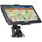
- 【Latest 2026 North America Maps】 OHREX 7" GPS Navigator for Car Truck RV works completely offline without cell service. It comes preloaded with 2026 North America maps (USA, Canada, Mexico) and does not require an internet or cellular connection to navigate.
- 【Free Lifetime Map Updates 】 Get the latest map by connecting OHREX GPS Navigation to the Windows pc. You can also use an exteranl TF Card for map update (with Mac & Windows system). Lifetime Map is free updated without Ads . You can regularly download latest data for maps, speed, and points of interest.
- 【Driver Alerts】 OHREX N700 GPS uses satellite positioning to determine your location and provides turn-by-turn voice guidance, speed camera and real-time alerts even in areas with no cell service — perfect for remote truck and RV routes.
- 【Professional GPS Navigation】 OHREX 7 inch TouchScreen GPS Navigation for Car Truck Motorhome & RV.(1) You can Customize Route According to Your Vehicle’s Weight, Length, Height and Width, Avoid Roads with Width/Height/Weight Restrictions (2) Intelligent Route Planning Fast & Economical. (3) Fast & Accurate GPS Tracking. (4) Displays Current Speed and ETA.
- 【Professional Solution】OHREX GPS navigation supply regular maps upgrades and any question inquiry. USA local brand, established professional technician team in the United States, have been recognized by our customers.
During a project, assign ownership for updates. The person responsible should record when each source was checked, what changed, who approved the response and whether drivers were notified. If a closure occurs en route, drivers should not improvise around a restriction; they should stop at the designated safe location and contact the project or route coordinator.
The Tool Desk
Outbyte Driver Updater FREEScan for outdated or missing drivers - takes under a minuteDriver Scan →Outbyte PC Repair FREERepair Windows errors before they cause bigger problemsFix Now →Can OpenStreetMap be used for truck routing?
Yes, but use it as a starting layer rather than the sole authority for a high-consequence delivery. OpenStreetMap data can be downloaded by area or feature and reused under its open-data license with attribution. Routing documentation identifies useful tags such as maxspeed, surface and maxweight.
Coverage and currency are uneven. Restrictions may be incomplete, and a routing service may lag behind an edit. OSM geometry also may not contain the authoritative measurement or legal wording needed for a permit. Corroborate OSM with state and local transportation records, bridge and permit information, current construction notices and a route survey. Preserve the OSM extract date and attribution in the route package so later reviewers know exactly which version was used.
Common failure modes and corrective actions
The shortest route crosses a low bridge
Cause: The bridge has no height attribute, an outdated value or a restriction that applies only to the truck’s direction. Fix: Add authoritative clearance data, model direction and lane rules, and verify the posted sign and physical structure during the survey. Do not proceed on an inferred clearance.
The network routes through a road closed for construction
Cause: The temporary event was never loaded or the routing service has not refreshed it. Fix: Maintain a dated temporary-restriction layer, check agency notices before dispatch and add the closure to the analytical network immediately.
Quick wins for a faster PC:
Scan for outdated or missing drivers - takes under a minuteDriver Scan →Clear out junk files and repair common Windows errorsFree Scan →The truck clears the map but cannot make the turn
Cause: Centerline routing ignores swept path, curb geometry, parked vehicles, opposing traffic or trailer off-tracking. Fix: Survey the complete movement, measure corner and lane geometry, and use a swept-path analysis appropriate to the actual tractor and trailer.
Best Value
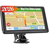
- 【2026 Free Lifetime Map Updates】Preinstalled with the 2026 latest maps of North America with free lifetime updates, include USA Canada Mexico Maps. If you would like to update the latest maps(or EU,UK, Ireland, Australia), please contact us to download.
- 【Driver Alerts】7 inch GPS Navigator for car trucks supports intelligent driver alerts, with detailed maps and turn-by-turn directions that speak loud and clear through the speaker for dangerous curves, speed changes, speed cameras, railroad crossings, animal crossings, and traffic lights.
- 【Custom Routing】LOVPOI GPS Navigation supports Multiple Vehicle Modes: including Car, Truck (Pickup Truck Commercial/Semi Truck), Ambulance, Bus and Taxi. For example truck mode: customized truck route for the size and weight of your truck, alerts for upcoming bridge heights, and weight limits.
- 【GPS Navigation System 】(1) Supports postal codes, address, coordinates and POI, (2)Turn-by-Turn Real Voice Broadcast in over 40 languages, (3) Intelligent Route Planning Fast & Economical, (4)FM Transmitter. (Not FM radio); (5) Provide 2D / 3D map view mode; (6) Automatically view day & night mode. (7) Display the distance to destination, estimated arrival time and current speed.
- 【LOVPOI SUPPORT】LOVPOI established professional technician team in the United States , supply regular maps upgrades , and provid answers to any questions asked. *Note: after receiving GPS navigation, please use the car charger to fully charge then use.If the satellite signal can not be searched, it may be because of the reason at home, please search the signal in outdoors again.
A “backup” route fails at the same bottleneck
Cause: Both candidates depend on one bridge, corridor or railroad crossing. Fix: Compare route dependencies and select a contingency with independent access, then verify its restrictions and staging.
The route is legal but unacceptable to the community
Cause: The comparison ignored residential exposure, noise, curb access, pedestrian activity or school operations. Fix: Include community and safety criteria in route approval, coordinate with agencies and adjust delivery windows or access points.
The field survey is not reproducible
Cause: Photos and notes lack location, date, direction or vehicle assumptions. Fix: Tie every observation to a map position, retain original media and record the survey team, equipment and conditions.
Do these 3 things before closing this tab:
1Repair Windows errors before they cause bigger problems2Fix the driver behind crashes, sound loss and screen glitches3Clear out junk files and repair common Windows errorsBuild a dated route package
Keep one controlled package for each approved movement. It should contain:
- Vehicle and load assumptions, including dimensions, gross weight and axle weights.
- Source layers, authorities, capture dates, edits and restriction versions.
- Candidate routes, rejected-route reasons and the comparison matrix.
- Field-survey maps, measurements, photographs, videos and notes.
- Permits, escort or traffic-control requirements and agency contacts.
- Approved driver instructions, staging plan and contingency decisions.
- Pre-dispatch checks and records of every temporary restriction update.
This record makes the decision auditable and lets the team reroute quickly when a bridge, work zone, weather event or site condition changes.
How the workflow scales from one delivery to a program
One-off or occasional delivery
Use the best available authoritative network, document the vehicle, generate multiple candidates, survey the complete route and obtain permits. The value is in resolving uncertainty before the truck moves.
Repeated deliveries over a project
Maintain a restriction calendar, approved route revisions, standard vehicle profiles and a contact list for agencies and carriers. Recheck temporary conditions before every delivery window and resurvey locations affected by construction or traffic-control changes.
Free tools Windows power users keep installed
One-click scans. No signup required.
Large or multi-project operation
Use an enterprise GIS or restriction-management platform capable of linear-referenced roadway attributes, events and constrained routing. Establish data stewardship, update intervals, approval roles and an audit trail. FHWA’s roadway specifications and ODOT’s oversize/overweight example illustrate why permanent, temporary and analytical restrictions should be managed separately.
Quick Recap
Product prices and availability are accurate as of the date/time indicated and are subject to change. Any price and availability information displayed on Amazon at the time of purchase will apply.

