Yes. A park or building can be built over an active highway by spanning or covering the roadway with a structural deck designed to carry the proposed uses above it. The deck, its foundations, waterproofing and drainage are the essential project; landscaping or buildings are only the visible surface. The highway can remain open underneath, but every design must fit its particular roadway, ground conditions, structures, utilities, access needs and construction constraints.
What a highway cap does
A highway cap—also called a deck park, highway cover, highway lid or land bridge—is a structural cover that creates usable space above a road. Foundations transfer loads into the ground; piers, beams or other structural elements support the deck across the roadway; and the deck carries the park, building or other surface program. The road remains below, so the project must preserve the roadway’s operation and required clearance while making the top level safe and useful.


As an Amazon Associate I earn from qualifying purchases.
The term “cap” describes the broad intervention, not a standard design. A cap may support open space, paths, trees, event areas, buildings, utilities or a mix of uses. Each program brings different weight, depth, access and servicing needs. A park and a building can both be placed over a highway, but they are not interchangeable loads or layouts, and there is no universal cap detail that can simply be repeated at another site.
For a construction project, the first task is therefore not choosing paving or planting. It is establishing what the road, ground, existing bridges and retaining walls can accommodate, where supports can go, and what the intended surface must carry. The structure and the public realm have to be designed as one coordinated project.
#1 Best Overall
What determines whether the site can support a cap
Roadway, foundations and existing structures
Designers need to understand the available right-of-way, roadway clearance, ground conditions, and the position and condition of existing walls, bridges and utilities. Those constraints affect where foundations can be installed and how the deck can span the highway. A support that works on an open site may be impossible where it would conflict with traffic, an existing retaining wall or buried infrastructure.
Loads also depend on the surface design. The deck must be planned for the actual combination of its own weight and the weight of the features it will support: soil, trees, paving, people, events, buildings and services. The allowable loads and available depth are project-specific. A planting plan should not be settled independently of the structure, and a proposed building should not be treated as a light landscape feature.
Program, soil depth and utilities
Paths and paved areas, lawns, mature planting and buildings have different structural and spatial demands. Trees require soil and room for roots; amenities and buildings need routes for utilities and a way to connect to services. Those requirements influence deck depth, support locations and the arrangement of fill above the structure. Where several uses are planned, the design must coordinate their loads and servicing rather than assume that every part of the cap can accommodate every use.
Quick wins for a faster PC:
Scan for outdated or missing drivers - takes under a minuteDriver Scan →Repair Windows errors before they cause bigger problemsFix Now →Austin’s Our Future 35 concept, for example, includes planned utility connections for future amenities and buildings. That is a planning feature of this program, not evidence that the same utility arrangement is suitable at another site.
Waterproofing, drainage and planting
Water management is a structural durability issue as well as a landscape issue. Water that reaches the deck needs a planned route away from the structure and the roadway below. The design has to coordinate waterproofing, drainage layers, soil and planting so that roots can grow while water is directed appropriately. The specific materials and layers vary by project; examples from one cap are not a universal specification.
Seattle’s Freeway Park also illustrates why the planting concept must match the structure. The Federal Highway Administration’s profile notes that the original structure did not support some of the trees planted in the park. The practical lesson is to resolve what the structure can carry and what the planting needs before the landscape is fixed, then plan for the upkeep needed to sustain it.
How to organize the design process
- Set the purpose and scope. Establish whether the project is intended to provide a park, connections across a highway, building sites or a combination. Identify who will use the space and what routes or destinations it should serve. A clear program gives structural and civil designers something specific to test.
- Investigate the site and highway. Document roadway geometry and clearance, right-of-way, ground and foundation conditions, existing retaining walls and bridges, and known utilities. Identify the constraints on working near the road and locations where supports may conflict with existing infrastructure. The resulting site information should guide the options, not be treated as a final design by itself.
- Test structural concepts against the program. Develop support and deck options that can carry the intended loads while fitting the available space. Coordinate foundation locations, spans, deck depth, building or landscape loads and utility routes. Where the site is constrained, structural choices may be driven as much by avoiding conflicts and limiting added weight as by the desired layout above.
- Design the surface as a connected place. Set entry points and accessible routes, and connect paths to the surrounding sidewalk, bicycle network, transit and neighborhood destinations where relevant. Check changes in grade and make sure the cap works as a route across the highway as well as a destination. Austin’s concept emphasizes east–west access and walking and cycling connections, including a north–south trail concept; those are program goals for that project, not standard requirements.
- Coordinate water, planting and building services. Align waterproofing and drainage with soil depths, roots, paving and the intended uses. Plan utility connections and access to services for amenities or buildings. Confirm that the proposed planting fits the deck’s capacity rather than relying on a landscape plan that the structure cannot support.
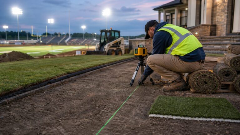
- Plan construction around live traffic. Develop a sequence for installing supports and beams, placing the deck and completing layers above it while coordinating with highway operations and existing infrastructure. Assess where equipment, cranes and deliveries can work, what access they need, and what traffic staging or lane closures may be required. The sequence and traffic arrangements depend on the project; a park’s finished appearance does not reveal the construction coordination beneath it.
- Provide for operation and long-term care. Decide who will maintain the park or other public space, how maintenance access will work and how drainage, planting, lighting, seating and other facilities will be managed. Include community priorities and public access in the design review. A cap is a long-lived structure and public place, not a one-time construction product.
Examples: what has been built, proposed or is under construction
The projects below illustrate different approaches and stages. Their dimensions, materials and program figures describe those projects only; they are not common design standards or a basis for ranking feasibility, cost or performance.
Free tools Windows power users keep installed
One-click scans. No signup required.
| Project | Status and scale reported | Relevant design lesson |
|---|---|---|
| Pittsburgh: I-579 Urban Open Space Cap / Frankie Pace Park | HDR reports completion in late 2021; about 300 feet of interstate covered by a three-acre park. | Constrained roadway and walls shaped the support and dead-load strategy. |
| Austin: Our Future 35 | Arup describes a conceptual cap-park and stitch-bridge program with more than 30 acres of proposed open space; concept designs were presented at a City-hosted open house in September 2024. | Connectivity, community engagement and planned utility links are part of the proposal. |
| Philadelphia: The Park at Penn’s Landing / Central Access Philadelphia | A September 4, 2026 project update describes construction over I-95. | Supports, beams, concrete, fill, planting and drainage layers, and provisions for buildings beyond the cap are coordinated as part of the build. |
| Seattle: Freeway Park | FHWA says the park opened over I-5 in July 1976 and covers 5.2 acres. | Later improvements address access, accessibility, drainage, planting and ongoing use. |
| Dallas: Southern Gateway Deck Park | FHWA describes a planned cap over I-35E; its profile’s projected schedule dates are historical and should not be read as current. | The project illustrates a stated goal of reconnecting Oak Cliff and adding recreational and educational uses, not a verified current delivery date. |
Pittsburgh: fitting a structure into a tight corridor
HDR reports that the I-579 cap links the Hill District and downtown Pittsburgh with a walkable connection. The site was bordered by bridges and retaining walls, limiting construction space and influencing how the deck could be supported. More than 200 drilled micropiles supported new abutments. Drilled shafts and slender multicolumn piers were used to limit impact on the roadway, while buried geofoam reduced soil dead load. Redundant waterproofing and aggregate drainage protected the deck.
Rank #3
These are project-specific decisions, not a recipe for another highway. The useful point is how multiple constraints—existing walls, limited work areas and soil weight—shaped the foundation, supports and material choices together. HDR also describes a listening and design-review process with residents and community organizations, with work by local artists incorporated into the park.
Austin: planning connections before construction
Arup describes Our Future 35 as a City of Austin program developing conceptual designs for cap parks and stitch bridges over I-35. Its vision includes more than 30 acres of proposed open space, community engagement, walking and cycling paths, cultural uses and planned utility links for future amenities and buildings. Arup says concept designs were presented at a City-hosted open house in September 2024. This is a planning program and proposal, not a completed park.
The concept’s emphasis on east–west access and a north–south trail shows how movement can shape the layout from the outset. The value of a cap is not determined by its acreage alone: its entries and routes need to connect people to places on either side and to the wider network.
Recommended Free Tools
Philadelphia: building the layers above I-95
The Park at Penn’s Landing is being built over I-95 as part of Central Access Philadelphia. In a September 4, 2026 update, the project describes installing new supports and beams, then concrete and fill layers that include troughs and different soil or fill conditions for roots and drainage. The update also describes utilities and supports for buildings in fill beyond the cap. It says the new cap is about four times the size of the previous one and that stronger supports were needed; those descriptions apply to this project and are attributed to its update.
Rank #4
Construction coordination includes details that may not be visible in the completed park. The update quotes CAP Construction Manager Frank Bonito: “Temperature also affects steel beams, so engineers and contractors account for expansion and contraction when installing them.” The project’s sequence and engineering response should not be generalized to other structures.
Seattle and Dallas: the importance of stewardship and status
Seattle’s Freeway Park demonstrates that a highway cap can become an established civic space: FHWA records its opening over I-5 in July 1976 and an area of 5.2 acres. Its improvement program covers entrances, accessibility, lighting, wayfinding, planting, drainage, irrigation, seating, restrooms, programming and services. These items show that continuing access and maintenance are part of the life of a cap, not finishing touches that can be ignored after opening.
FHWA’s Southern Gateway profile describes Dallas’s planned I-35E cap park as a way to reconnect Oak Cliff and provide recreational and educational uses. The profile includes projected dates from an earlier planning period, so those dates should not be treated as a current schedule. Its stated goals can inform the discussion of project purpose, but the page does not establish present delivery status.
What’s actually slowing this PC down?
Pick the symptom - the matching free tool is one click away.
Construction and public access while the highway remains open
Keeping a highway active beneath a project makes construction staging central to design. New supports and beams have to be installed in a corridor already occupied by traffic and infrastructure. Designers and builders must coordinate the work sequence, equipment access and protection of existing structures with the needs of the highway operator. Depending on the site and construction plan, traffic arrangements may involve staged work or lane closures; there is no single arrangement that applies to every cap.
Best Value
Planning must also account for the eventual routes onto and across the deck. A cap that occupies space above a road but is hard to enter, inaccessible across grade changes or disconnected from nearby routes may not meet its public purpose. In Austin’s proposal, east–west neighborhood access and walking and cycling connections are explicit aims. Pittsburgh’s completed project provides a physical, walkable link between the Hill District and downtown. These are descriptions of project goals and connections, not proof of broader social or economic outcomes.
Community priorities and maintenance belong in the brief
Residents and local organizations can help define what the space should do, where it should connect and which cultural or recreational uses matter. Pittsburgh’s project included resident and community-organization input through listening and design review, and incorporated local artists’ work. Austin’s program includes community engagement in its concept development. Those examples show different ways community input can inform a project; they do not establish a single required consultation model.
Long-term management needs equal attention. The owner or steward must be able to reach and maintain the surface, address drainage and irrigation, care for planting, and manage facilities such as lighting, seating and restrooms where provided. Seattle’s improvement program documents how access, planting, drainage and services can require later attention. The available project information does not establish a general cost comparison between parks and buildings over highways, or a universal return on investment. Such comparisons depend on site conditions, the program, construction and continuing responsibilities.
What a highway cap can—and cannot—promise
A cap can create usable space above a roadway and, if planned well, provide a route or destination that connects places separated by the highway. Its results depend on the structural design, the uses it supports, the quality of its access and the care it receives. Covering a highway alone does not establish that a project will resolve pollution, noise, safety, equity or economic concerns; those outcomes require evidence specific to the site and project.
For owners and communities considering a cap, the practical test is whether the transportation structure, foundations, deck, surface program, access, construction sequence and long-term stewardship can be made to work together. The built Pittsburgh and Seattle projects, the proposed Austin program and Philadelphia’s ongoing construction show that the broad idea can take several forms—and that its details must be worked out for each place.
Quick Recap
Product prices and availability are accurate as of the date/time indicated and are subject to change. Any price and availability information displayed on Amazon at the time of purchase will apply.