Crashes, No Sound, or Screen Glitches?
Random freezes, missing sound and display glitches usually trace back to one bad driver. Find and replace yours safely.Free scan · under a minuteWindows Errors? Fix Them Before They Spread
Repair common Windows errors and clear accumulated junk for a smoother, more stable PC - no reinstall needed.Free scan · no reinstallAssessing land for a utility-scale solar project is a combined grid, planning, engineering, environmental, legal and community decision—not a sunlight-only exercise. A parcel merits further development only when it has a workable point of interconnection, enough contiguous net buildable area, acceptable terrain and drainage, controllable land rights, a plausible permitting path, and economics that survive upgrade, civil and mitigation costs.
Use the process below to screen parcels in the United States. It will identify fatal flaws early, show which constraints can be mitigated, and define the specialist studies needed before you commit to a lease, purchase or development budget. Local zoning, permits, utility rules and environmental requirements must be confirmed for the actual county and state.
As an Amazon Associate I earn from qualifying purchases.
Start by defining the project you are trying to build
Land requirements depend on the project configuration. Before comparing parcels, write down the assumptions that will drive design and approvals:
The Tool Desk
Outbyte PC Repair FREERepair Windows errors before they cause bigger problemsFix Now →Outbyte Driver Updater FREEScan for outdated or missing drivers - takes under a minuteDriver Scan →- Target size and technology: planned direct-current (DC) and alternating-current (AC) capacity, fixed-tilt or tracking arrays, inverter arrangement, battery storage, substation and collection system.
- Offtake: the likely utility, corporate or other power purchaser, delivery requirements and target commercial-operation date. The purchaser and delivery point affect interconnection studies, revenue and schedule.
- Grid location: the intended point of interconnection (POI), voltage level, export limit and whether a shared or new substation is contemplated.
- Land context: private, public, agricultural, brownfield or other land; expected lease or acquisition structure; and any off-site corridor needed for gen-tie, access or drainage.
- Schedule and risk tolerance: whether the project can absorb a multi-year interconnection queue, extended permitting, seasonal environmental surveys or redesign.
DOE’s Large-Scale Solar Siting Research identifies power purchaser, interconnection cost, transmission access, land cost, terrain, environmental effects and host-community priorities as connected siting considerations. Those assumptions should be fixed before you assign a parcel a score; changing them later can change the acreage, POI and permit strategy.
#1 Best Overall

- VERSATILE DIGITAL ANGLE GAUGE AND LEVEL: Measure angles, check relative angles with zero calibration feature, or use as a digital level with ease
- HIGH VISIBILITY AND AUTO-ROTATING DISPLAY: Reverse contrast display improves visibility in low light conditions and automatically rotates when upside-down for easy viewing
- STRONG MAGNETIC BASE: Attach to ferromagnetic surfaces like pipe, electrical conduit, miter saw blades for woodworking, vents, ducts, and more for convenient hands-free operation
- V-GROOVE EDGES: Ensure optimal alignment on conduits and pipes for bending and alignment tasks
- WIDE MEASUREMENT RANGE: Measure between 0-90, or 0-180 degrees - useful when accounting for springback when bending conduit
DOE generally describes large-scale solar as more than 1 MW. National projections attributed by DOE to the Solar Futures Study estimate roughly 5.7 million acres could be used for solar by 2035 and as much as 10 million acres by 2050. Those are national scenarios, not a requirement for an individual project.
Run a desktop fatal-flaw screen before spending on studies
Build a parcel map in a geographic information system using current agency and utility data. The screen is for triage: a blank or outdated layer does not prove that a constraint is absent. Record the data source and date for every layer so a later reviewer can reproduce the decision.
Map the physical envelope
- Parcel boundaries, adjoining parcels and whether they form one usable, contiguous area.
- Elevation, slope, aspect and ridgelines; flag steep or irregular ground that could require extensive grading or special foundations.
- Road frontage, bridge limits, turning radii and likely routes for oversized transformers, pile deliveries and construction traffic.
- Existing buildings, towers, tree lines and other edge obstructions that can shade modules or limit setbacks.
- Streams, ponds, drainage paths, wetlands, floodplains and low areas that may be unavailable or require redesigned stormwater controls.
- Current land use, agricultural classification, brownfield history, mining or industrial features and planned neighboring infrastructure.
Map legal, regulatory and conservation constraints
- Zoning district, conditional-use or special-use requirements, overlay districts and local solar siting standards.
- Known utility, access, drainage, conservation, pipeline, mineral, telecommunications and other easements.
- Protected lands, critical habitat, threatened or endangered species records, wetlands and water resources.
- Historic districts, archaeological sensitivity, cemeteries and other cultural-resource indicators.
- Prime farmland, state or local agricultural protections, conservation restrictions and required buffers.
- Existing or planned rights-of-way that could affect the array, gen-tie or construction access.
NLR’s solar training material emphasizes reviewing topography, access, soils, environmental conditions, title and easements, and zoning before advancing a site. Use its Module 3 text version as a practical checklist, then verify each item with the responsible authority.
How much land does a utility-scale solar project need?
Size the project from net buildable acreage, not the gross parcel number. Remove setbacks, wetlands, flood-prone areas, steep slopes, protected habitat, roads, drainage facilities, substations, collection corridors, fire access and other required infrastructure before calculating the array footprint.
Use acreage rules only as an early estimate
NREL’s Community Planning for Solar: Conducting a Solar Resource and Infrastructure Assessment (March 2022) gives a rough estimate of 4–5 acres per MW DC for large ground-mounted photovoltaic facilities in Massachusetts. It is not a national design standard. Tracker geometry, row spacing, slope, snow, setbacks, storage, topography and local code can move the result substantially.
| Screening input | What to calculate | Why it changes the answer |
|---|---|---|
| Gross parcel area | Total recorded acreage | Includes land that may be legally or physically unusable. |
| Constrained area | Wetlands, floodplain, habitat, steep slopes, setbacks, easements and protected resources | May be excluded outright or require buffers, permits or mitigation. |
| Infrastructure area | Roads, access lanes, inverters, substation, operations space, drainage and fire access | Reduces the module field even on otherwise suitable ground. |
| Net buildable area | Contiguous land remaining after constraints and infrastructure | Determines whether the planned MW can fit without fragmented blocks. |
| Layout capacity | MW DC and AC from a preliminary block layout | Accounts for module technology, row spacing, orientation and electrical losses. |
Do not sign a land agreement based solely on a gross-acre promise. Attach a conceptual layout and define how setbacks, excluded resources, access, gen-tie corridors and later survey findings will be handled.
Check the grid before treating a parcel as viable
A visible transmission line or nearby substation does not establish available interconnection capacity. The circuit may be constrained, the substation may have no deliverability, or required network upgrades may make the project uneconomic.
Free tools Windows power users keep installed
One-click scans. No signup required.
Identify the likely point of interconnection
- Determine which electric utility, transmission owner or regional transmission organization controls the facilities serving the parcel.
- Map candidate substations, line voltages, circuit paths and a feasible gen-tie route. Confirm ownership rather than relying on a third-party map.
- Ask the utility for the applicable interconnection process, queue requirements, study deposits, data requests and technical screens.
- Submit a preliminary inquiry or formal request at the earliest practical stage. Ask whether capacity is available, what export limit is plausible, and which transmission or distribution upgrades could be triggered.
- Request the utility’s estimated study sequence, upgrade scope, cost allocation and schedule. Treat every figure as preliminary until it appears in the applicable study or agreement.
DOE’s siting framework links interconnection access and cost directly to site selection; see its large-scale solar siting guidance. Keep the POI, capacity assumption, upgrade estimate and study status in the parcel scorecard. A site with excellent solar resource can fail if its POI requires an unaffordable line rebuild or an uncertain queue position.
Rank #2
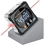
- Nivel Digital Level with Laser - (Class II laser, Output<5mW) L2.4in, W2.4in, H1.2in, portable pocket size with matching belt bag. ±0.2° precise microprocessor with automatic inversion when upside down. 4*90° measurement can be used at many angles and can be zeroed at any angle for comparison.
- Craftsman's Choice - Not only the baseboard, but also the strong magnetic upgrade at the four sides. Never slide on the table saw blade or any metal surface. Magnetic feature and lasers are great advantages for measuring, cutting, leveling in woodworking renovations and building furniture.
- Save time and effort hanging decorations - Dual lasers are great helper for horizontal and symmetrical installation. Furthermore, this digital leveler tool maybe a great gift for father's day, birthdays, Christmas.
- This inclinometer, digital angle finder comes complete with a USB-C charging cable for the internal 340mAH rechargeable battery. It also has dust-proof and IP67 waterproof performance with bright red backlight. Even in garage, with the door open and the sunshine pouring in, you can easily read the display.
- Technical Parameters - Material: aluminum alloy| Measuring range: 4*90°| Resolution: 0.05°| Accuracy: ±0.2°| Repeatability: 0.1°| Power supply: 3.7V lithium battery| Working temperature: 14-122℉
Reserve the physical corridor
Interconnection is also a land-rights problem. Confirm that the proposed gen-tie, substation, access road and communications route can cross land controlled by the project, or that neighboring owners could grant the required easements. Check crossing rights, construction laydown, outage requirements and vegetation clearing. A technically acceptable POI is not usable if the project cannot secure the route.
Inspect terrain, soils, drainage and access in the field
Desktop maps cannot show every condition that changes grading, foundations or construction logistics. As NLR engineer Lars Lisell puts it, “And very important is to walk the site.” Use a field visit to test the desktop assumptions, not to replace survey or engineering.
Site-walk checklist
- Drive every proposed delivery route and note narrow roads, weak bridges, steep grades, overhead clearances and turnarounds.
- Walk parcel edges and interior routes to identify shading, trees, neighboring uses, fences, encroachments and visible setbacks.
- Observe drainage paths, ponding, erosion, culverts, wet ground and signs of flood exposure after recent weather when possible.
- Look for exposed bedrock, boulders, fill, sandy or corrosive soils, sinkholes, former industrial activity and evidence of contamination.
- Check whether slopes and irregular contours would require major cut-and-fill or leave disconnected blocks too small for efficient arrays.
- Photograph access points and constraints, record approximate locations and preserve the date and weather conditions.
A phone-level observation or optional digital inclinometer can provide a rough slope check during reconnaissance, but it is not surveyed topography. Advance viable parcels to a licensed surveyor, civil engineer and geotechnical professional for design-level conclusions. Geotechnical findings can change pile type, refusal risk, foundation cost, drainage design and construction duration.
What’s actually slowing this PC down?
Pick the symptom - the matching free tool is one click away.
Verify ownership, title and development rights
Confirm that the person offering the parcel can grant every right the project needs. Order a current title commitment and have counsel review:
- Recorded owner, liens, mortgages, tax status and entity authority.
- Existing leases, options, mineral or timber rights, hunting rights and other severed interests.
- Utility, access, conservation, pipeline, drainage and telecommunications easements.
- Road rights-of-way, setback lines, encroachments and boundary uncertainties.
- Conservation restrictions, agricultural covenants or deed provisions that limit solar, grading or tree removal.
- Rights for the gen-tie, substation, access and temporary construction areas on neighboring land.
Make the land agreement conditional on due diligence, permits, interconnection progress and the ability to obtain required off-site rights. Define survey access, exclusivity, extension options, decommissioning obligations, restoration standards, insurance and who pays taxes and infrastructure costs. A signed lease does not cure a missing easement or an owner who lacks authority to grant the needed right.
Determine the actual zoning and permit path
Solar siting rules differ by state, county and municipality. DOE’s Large-Scale Solar Siting Resources explains that local laws and regulations are not uniform. Do not apply a nationwide permit checklist to a parcel without confirming the governing authority.
Questions for the planning authority
- Is utility-scale solar allowed by right, conditional use, special exception or only through a rezoning?
- Which body decides the application, and what are the hearing, notice and appeal steps?
- What setbacks, height limits, fencing, glare controls, vegetation buffers, visual studies and decommissioning security apply?
- Are there limits or special rules for prime farmland, forest clearing, brownfields, steep slopes, floodplains or scenic areas?
- Which stormwater, erosion and grading permits are required, and at what project size?
- Are building, electrical, fire, road-opening, wetlands, waterway, endangered-species or cultural-resource approvals triggered?
The NLR transcript includes the statement that “if your site is an acre or more, you’re going to need a construction storm water permit.” Treat that as a general training statement, not a universal legal conclusion. Federal and state thresholds, exemptions and delegated programs vary; confirm current requirements with the applicable environmental agency.
Do these 3 things before closing this tab:
1Fix the driver behind crashes, sound loss and screen glitches2Repair Windows errors before they cause bigger problems3Scan for outdated or missing drivers - takes under a minuteAlso determine whether a federal nexus exists. Federal environmental review is not automatically required for every private solar project; triggers can arise from federal land, federal funding, permits or other specific actions. Have environmental counsel or a qualified consultant identify the actual triggers.
Rank #3

- FOUR SIDES STRONG MAGNETIC — Digital laser level has strong magnets on four sides that firmly adsorb on the measuring object, ensuring accuracy and not easily falling off. Three easily operated buttons can activate the built-in red laser line on both sides, hold the measured value, switch the unit of the measured value and zeroing function to realize relative measurement.
- THREE IN ONE — This tool has the functions of digital level, angle finder and laser lines(Class II, Output<5mW). Visible measurement value avoids staring at the bubbles in the traditional tube and quickly obtains the level status. Two built-in laser liners are convenient and effective to carry out the horizontal and symmetrical work of home decoration. The zero button can effectively realize absolute or relative angle measurement.
- PROVIDE ACCURACY & CONVENIENT — 360°/4×90° measure angle, the measured value on the display is automatically adjusted. The hold button can memorize the measured values is convenient for taking measurements in narrow spaces, inverted situations, and curved pipes. Display value flipped automatically when mounted upside down, with ±0.2° accuracy and 0.05° resolution to ensure accurate measurement every time.
- BACKLIGHT LCD DISPLAY — Digital angle finder with an easy-to-read display for clear measurement results in any lighting conditions. IP54. The palm-sized, compact design of the angle gauge is easy to carry with a black belt loop storage bag, no matter whether indoors or outdoors is convenient to use. 400mAh, rechargeable, ultra-long standby time, the power display for easy charging in time.
- PORTABLE & RELIABLE- Lightweight and heavy-duty digital angle finder tool is easy to carry and use, meets most woodworking, operation, home maintenance and decoration needs. Also a great gift for men at festivals. Coobeast tools have quality assurance, feel free to contact us if there are any problems with the product. We provide you with service for the first time.
Screen environmental, agricultural and cultural effects
Wetlands, waters and flood risk
Map wetlands, streams, ponds and floodplains, then verify boundaries with field delineation where a project could affect them. Ask whether access roads, collection trenches, grading or drainage outfalls would require authorizations. Preserve room for stormwater treatment and emergency access rather than filling every open area with modules.
Species and habitat
Review known critical habitat and threatened or endangered species records, but do not treat an empty database result as clearance. Seasonal surveys may be needed for birds, bats, plants, reptiles or other species. Redesigning around a sensitive area can preserve a project; discovering it after layout and lease commitments can cause delay and mitigation cost.
Historic and cultural resources
Check historic registers, archaeological sensitivity and tribal or cultural-resource requirements through the relevant authorities. Construction grading, trenching and access can affect resources outside the module footprint.
Recommended Free Tools
Agricultural land
For agricultural parcels, compare the project with state and local farmland protections and document the agricultural impact. USDA NRCS guidance recommends considering marginal, unproductive or abandoned areas where possible while protecting prime farmland and sensitive resources. Review the Conservation Guidance for Utility-Scale Solar Projects when evaluating agricultural siting, soil conservation and coexistence options.
Do not assume that agrivoltaics, grazing or pollinator habitat eliminates permitting or engineering obligations. Those approaches can affect fencing, vegetation management, fire safety, soil compaction, insurance and operating practices.
Evaluate host-community fit early
Community acceptance affects schedule and sometimes the legal ability to build. Speak with local officials, neighbors, emergency services, agricultural stakeholders and other affected groups before the design is fixed. Explain:
- Expected construction traffic, road use, noise, lighting, fencing and vegetation clearing.
- Drainage and erosion controls, flood response and who will maintain them.
- Viewshed changes, glare analysis, screening and setbacks.
- Property-tax treatment, local employment, lease income and other benefits that are actually available.
- How agricultural production, grazing, pollinator habitat or conservation areas will be maintained where proposed.
- Decommissioning, financial security and site restoration commitments.
Record concerns and convert them into design requirements, permit commitments or open diligence items. DOE notes that siting decisions affect communities, ecosystems, agriculture, project costs and timelines; community fit belongs in the initial comparison, not as a final public-relations exercise.
Compare surviving parcels with one transparent scorecard
After the fatal-flaw screen, compare only sites that have a plausible development path. Use the same assumptions, units and data dates for every parcel. A simple weighted score can organize discussion, but never let a high score hide a legal or interconnection fatal flaw.
Rank #4

- Ultra Small Digital Level Box - Measuring only 35mm in length and width, 20mm in thickness, it's as compact as a half-dollar coin. Carry this convenient tool in your pocket or hang it on your keychain for optimal accessibility. Ideal for magnetic angle finder applications.
- Experience the powerful magnetic convenience of this digital level box. The button side contains powerful magnets, ensuring stable fixing to any metal surface. Perfect for table saw blade angle gauge and other woodworking tasks.
- Enjoy the Clear & Bright Display with backlit feature, providing better visibility in any lighting condition. Whether you're working indoors or outdoors, our digital leveler delivers remarkable precision.
- Embrace the innovative rechargeable technology of our sophisticated digital level box. With a 230mAh Long-Lasting battery and Automatic shutdown after 3 minutes of non-use, this hgh-class tool ensures uninterrupted performance. Convenient Type-C charging adds to its unparalleled convenience. Perfect for woodworkers and professionals seeking a top-tier level.
- With an accuracy of ± 0.2°, it delivers pristine measurements for your projects. Its unique IP67 Water Proof and Dust Proof design ensures reliable performance even in challenging environments. A Prestigious tool for machinists and those in search of unparalleled precision.
| Axis | Evidence to record | Decision treatment |
|---|---|---|
| Solar resource and modeled yield | Site-appropriate resource data, preliminary layout, losses, tracking assumption and expected annual energy | Compare modeled output under identical assumptions; flag uncertainty requiring a production study. |
| Net buildable acreage | Contiguous acres after setbacks, resources, access and infrastructure | Fatal if the planned MW cannot fit; otherwise quantify redesign or reduced capacity. |
| Interconnection | POI, voltage, capacity indication, study status, upgrade scope, cost and schedule | Fatal if no credible path or if upgrades exceed the project case; otherwise carry as a cost and schedule risk. |
| Terrain, soils and drainage | Slope, bedrock, soil risk, flood exposure, grading, stormwater and access findings | Price mitigations and require survey, civil and geotechnical confirmation. |
| Title and land control | Ownership, liens, easements, restrictions and off-site corridor rights | Fatal if required rights cannot be secured; otherwise make them conditions to closing or notice to proceed. |
| Zoning and permits | Allowed use, decision authority, hearings, studies, permit list and schedule | Separate known requirements from discretionary or uncertain approvals. |
| Environmental, cultural and agricultural effects | Wetlands, habitat, historic resources, farmland, views and mitigation needs | Exclude protected areas where required; quantify remaining acreage, mitigation and survey timing. |
| Acquisition and development cost | Lease or purchase, gen-tie, roads, grading, drainage, studies, mitigation and taxes | Use a range with explicit assumptions, contingencies and escalation. |
| Community fit | Stakeholder concerns, benefit commitments, visual and traffic impacts | Identify opposition, redesign needs and engagement actions before option exercise. |
Label each item fatal flaw, mitigable constraint or open diligence. Assign an owner and due date to every open item. Keep a separate assumptions register so a change in MW, POI or schedule updates all parcels consistently.
Independent reader supportYour contribution helps us test, update, and keep practical guides available for everyone.Move from screening to project-level diligence
A site should advance only when the screen supports a credible development hypothesis. The next stage normally includes:
- Utility process: submit the applicable interconnection request, pay required deposits and track study milestones, assumptions and upgrade estimates.
- Survey and layout: obtain boundary, topographic, wetland and utility surveys; prepare a conceptual civil and electrical layout showing setbacks, roads, drainage, collection, substation and gen-tie.
- Environmental studies: commission wetland delineation, habitat and species review, cultural-resource screening and other studies indicated by the location and permits.
- Geotechnical and civil investigation: test soils, groundwater, bedrock, corrosion, erosion and foundation conditions; develop grading and stormwater concepts.
- Title and corridor work: complete title review, secure options or easements and confirm access and construction rights.
- Permit schedule: obtain written direction from planning, building, stormwater, transportation and environmental authorities; include hearing, survey-season and appeal contingencies.
- Energy and financial model: update production, curtailment, interconnection, capital, operating, mitigation, tax and schedule assumptions; test downside cases.
Use qualified surveyors, civil and geotechnical engineers, environmental professionals, land counsel and interconnection specialists. Preliminary desktop screening is not a substitute for their signed work products.
Common mistakes and how to correct them
“The parcel is sunny, so it is suitable.”
Why it fails: solar resource cannot overcome unavailable interconnection, protected habitat, zoning prohibition or unusable terrain.
Correction: require a grid, net-acreage, title and permit screen before detailed production modeling.
“A transmission line borders the property, so capacity is available.”
Why it fails: line proximity says nothing about circuit loading, deliverability, study results or upgrade cost.
Correction: identify the owner and request the applicable interconnection data and studies.
Quick wins for a faster PC:
Scan for outdated or missing drivers - takes under a minuteDriver Scan →Repair Windows errors before they cause bigger problemsFix Now →Fix the driver behind crashes, sound loss and screen glitchesFind Drivers →“The parcel has enough gross acres.”
Why it fails: setbacks, wetlands, floodplain, access, drainage, habitat and infrastructure consume land and can fragment the layout.
Best Value

- High Precision Measurement for Accurate Results: This digital angle finder delivers ultra-accurate readings with full coverage of 4×90°, allowing easy measurement of absolute or relative angles and inclinations in any situation. With an accuracy of ±0.2°, it’s perfect for precise tasks in woodworking, construction, and table saw operations, ensuring reliable results every time.
- LED Display: Equipped with a large, clear LED display, this angle gauge provides real-time data visibility even in daylight. This feature improves work efficiency for both indoor and outdoor tasks, eliminating struggles with hard-to-read measurements under varying light conditions.
- Powerful Magnetic Base: Magnetic design on all four sides for a solid attachment to metal surfaces - allows totally hands-free use and multi-angle alignment without slipping or moving.
- USB Rechargeable and Auto Shut-Off: Built-in rechargeable battery with USB charging capability ensures easy power replenishment on-site. It includes a data hold function and auto-shutoff after 3 minutes, extending battery life and facilitating continuous use during long work sessions, reducing the hassle of frequent battery replacements.
- Strong and Easy to Use Design: rugged outer shell resistant to impact and daily wear - simple operation with intuitive buttons: short press to turn on, long press to turn off, and ZERO button to reset the Angle.
Correction: draw a constrained-area map and calculate contiguous net buildable acreage.
“A desktop map shows no wetland or species issue.”
Why it fails: map coverage can be incomplete, old or too coarse for a project boundary.
Correction: walk the site and commission the field delineations and seasonal surveys indicated by the screening.
“One state’s solar checklist applies everywhere.”
Why it fails: zoning, stormwater, agricultural and environmental authority differs by locality.
Correction: obtain parcel-specific confirmation from the county, municipality, state agencies and utility.
“Community engagement can wait until the permit hearing.”
Why it fails: unresolved drainage, views, traffic or farmland concerns can force redesign or delay.
Correction: discuss impacts and benefits early, document commitments and incorporate feasible changes into the concept layout.
Decision gates for a go/no-go recommendation
Use three gates to prevent sunk-cost bias:
- Screen gate: no known fatal flaw in zoning, title, protected resources, access or basic grid path; sufficient contiguous net acreage for the target configuration.
- Diligence gate: utility process is active, surveys and specialist studies support the layout, land and corridor rights are controllable, and the permitting authority confirms a plausible path.
- Investment gate: modeled energy, interconnection and upgrade costs, civil works, mitigation, land, schedule, taxes and community commitments produce an acceptable risk-adjusted case.
If a gate fails, stop or redesign rather than allowing sunk study costs to dictate the decision. A smaller project, a different POI, a different parcel configuration or a non-agricultural portion of the property may resolve a constraint—but each change must be rechecked against grid, permits, land rights and economics.
What the final site file should contain
Before exercising an option or recommending acquisition, assemble a parcel file that another professional can audit:
- Parcel map with gross area, constraints, net buildable area and conceptual array layout.
- Data sources and dates for elevation, flood, wetlands, protected lands, zoning, utilities and land use.
- Site-walk photographs, access notes and preliminary slope observations.
- Utility correspondence, POI assumptions, study status, upgrade ranges and schedule.
- Title commitment, easement map, owner authority and proposed off-site rights.
- Planning and environmental agency correspondence and a permit responsibility matrix.
- Survey, environmental, geotechnical and civil scopes, findings and unresolved questions.
- Energy, capital, operating and schedule model with assumptions and sensitivity cases.
- Community engagement log, design commitments and outstanding concerns.
- Scorecard showing fatal flaws, mitigations, open items, owners and decision dates.
This record turns a promising map location into a defensible development decision and makes later design, permitting, financing and construction handoffs more reliable.
Quick Recap
Product prices and availability are accurate as of the date/time indicated and are subject to change. Any price and availability information displayed on Amazon at the time of purchase will apply.
Free tools Windows power users keep installed
One-click scans. No signup required.

