Quick wins for a faster PC:
Repair Windows errors before they cause bigger problemsFix Now →Scan for outdated or missing drivers - takes under a minuteDriver Scan →The startup described by this headline is Doxel. Its original system used autonomous robots equipped with LiDAR and cameras to scan construction sites, then applied cloud-based computer vision to compare what had actually been built with BIM models, schedules, and expected installation sequences.
The important qualification is that Doxel’s robot did not build the project. It measured construction progress. The company said that better measurement helped a San Diego medical-office project achieve a 38% increase in labor productivity and finish 11% under budget—figures that belong to a specific, company-reported case study rather than a universal construction benchmark. Doxel’s current public product positioning also emphasizes worker-captured 360-degree imagery rather than the autonomous LiDAR rover featured in its 2018 emergence from stealth.
As an Amazon Associate I earn from qualifying purchases.
What problem was Doxel trying to solve?
Construction teams often discover delays, incomplete work, installation errors, and rework only after the problem has become expensive. Progress reports may be periodic, manually prepared, or based on estimates that are difficult to verify. By the time a missed milestone is visible in a formal report, trades may already be stacked, materials may be ordered incorrectly, or corrective work may affect several downstream activities.
Recommended Free Tools
Doxel’s proposition was to make work in place measurable more frequently and objectively:
#1 Best Overall

- PRECISION YOU CAN TRUST: Built for professionals who need reliable results, this LiDAR scanner delivers high-accuracy capture for dependable point clouds and precise documentation. With ±20 mm accuracy at 10 m and 100K points per second, this 3D scanner brings confidence to complex spaces.
- CAPTURE MORE SPACE: With an extended scanning range of up to 100 m in E57 files, this lidar room scanner helps teams document large residential, commercial, and outdoor environments with fewer setups. It’s designed to map expansive areas quickly while preserving detail and accuracy.
- FAST, PRODUCTIVE SCANNING: Complete a scan in under 20 seconds with this professional 3D LiDAR scanner, powered by an advanced scan engine that helps increase productivity. Cover more spaces in less time without sacrificing the precision professionals depend on.
- BUILT FOR REAL-WORLD CONDITIONS: Designed for indoor and outdoor scanning, this LiDAR scanner performs in direct sunlight, low light, and mixed lighting conditions. Track accurate results in challenging environments without compromising performance.
- EXTENDED JOB-SITE POWER: Swappable, removable batteries support longer capture sessions and help minimize interruptions throughout the workday. This 3D LiDAR scanner is built for continuous operation, so you can stay productive from one project to the next with less downtime.
- Capture the physical state of the jobsite.
- Identify the installed components and their locations.
- Compare them with the BIM model and construction schedule.
- Detect missing, misplaced, or late work.
- Give project managers time to change sequencing, staffing, procurement, or trade coordination.
The intended economic benefit was therefore indirect. The robot was an information-gathering system. Productivity gains would come from earlier decisions, less rework, better labor allocation, and fewer surprises—not from replacing construction workers with a machine.
How the original Doxel robot worked
Doxel emerged from stealth in February 2018 with a reported $4.5 million funding round. Its early system combined four different technologies:
- LiDAR: Laser pulses measured the geometry of walls, pipes, ducts, equipment, and other visible site features.
- Cameras: Visual and color information helped the system interpret what the laser measurements represented.
- BIM: The building information model supplied planned geometry and component identity.
- Schedules: The project schedule supplied expected timing and installation sequence.
According to IEEE Spectrum’s 2018 report, the robot entered after the site shut down for the day and followed pre-scheduled routes, including routes involving stairs. Doxel said one robot could scan approximately 30,000 square meters over a week. The captured data was sent to the cloud, where computer-vision and deep-learning models analyzed it.
The Tool Desk
Outbyte PC Repair FREERepair Windows errors before they cause bigger problemsFix Now →Outbyte Driver Updater FREEFix the driver behind crashes, sound loss and screen glitchesFind Drivers →The goal was more ambitious than producing a point cloud. Doxel’s software attempted to recognize construction components by characteristics such as shape, size, and position; determine whether they had been installed; assess whether they were in the correct location; and compare observed progress with the planned sequence.
That distinction matters. A LiDAR scanner can measure geometry, but it does not inherently know whether a visible pipe is the correct specified pipe, whether a wall belongs to the current schedule activity, or whether an installation is complete according to the contract. Those conclusions require project context, models, rules, and software interpretation.
What did the reported 38% productivity improvement mean?
The most widely repeated result from the early Doxel story came from a multifloor medical-office project in San Diego, later identified in related material as the Kaiser Permanente Viewridge Medical Office project. Doxel said its system was associated with a 38% increase in labor productivity and that the project finished 11% under budget.
Those numbers should be read precisely. The 38% figure was reported as a comparison with the project’s original labor-productivity budget or estimate. It was not a claim that the robot performed 38% more physical construction work, nor is the available evidence an independently verified industry-wide benchmark. IEEE Spectrum reported the figures as Doxel’s case-study results; the available material does not establish a randomized trial, independent control group, or broad statistical sample.
Rank #2

- PRECISION YOU CAN TRUST: Built for professionals who need reliable results, this LiDAR scanner delivers high-accuracy capture for dependable point clouds and precise documentation. With ±20 mm accuracy at 10 m and 100K points per second, this 3D scanner brings confidence to complex spaces.
- CAPTURE MORE SPACE: With a 20 m standard range and extended scanning range of up to 100 m in E57 files, this lidar room scanner helps teams document large residential, commercial, and outdoor environments with fewer setups. It’s designed to map expansive areas quickly while preserving detail and accuracy.
- FAST, PRODUCTIVE SCANNING: Complete a scan in under 20 seconds with this professional 3D LiDAR scanner, powered by an advanced scan engine that helps increase productivity. Cover more spaces in less time without sacrificing the precision professionals depend on.
- BUILT FOR REAL-WORLD CONDITIONS: Designed for indoor and outdoor scanning, this LiDAR scanner performs in direct sunlight, low light, and mixed lighting conditions. Capture accurate results in challenging environments without compromising performance.
- EXTENDED JOB-SITE POWER: The Performance Kit includes dual removable batteries to support continuous scanning during extended sessions. Swap batteries as needed to keep your 3D LiDAR scanner running without pausing to recharge, helping maximize productivity on demanding job sites.
A careful description is:
Doxel said its monitoring system was associated with a 38% increase in labor productivity on a San Diego medical-office project and helped the project finish 11% under budget.
The result could reflect several mechanisms: earlier identification of delayed work, more accurate progress measurement, better crew allocation, reduced rework, and faster management intervention. It does not prove that every project using the same technology would achieve the same outcome.
Why AI mattered beyond scanning
Reality capture alone produces data. The construction value comes from turning that data into decisions.
Doxel’s reported AI workflow was intended to:
- Recognize individual construction components.
- Determine whether an item was installed.
- Check whether it was positioned correctly relative to the model.
- Measure quantities and work in place.
- Compare actual progress with the BIM model and schedule.
- Identify schedule risk and deviations.
- Support forecasts of completion timing and cost at completion.
This is why construction AI should not be described simply as “a camera that sees the site.” The difficult layer is semantic interpretation: connecting an observed object to a planned component, schedule activity, trade, quantity, and expected production rate.
Progress tracking is not the same as productivity
These terms are often used interchangeably, but they describe different measurements.
Progress concerns how much planned work is physically complete—for example, the percentage of ductwork installed on a floor. Productivity requires a denominator, such as labor hours, crew size, units installed per hour, or actual cost compared with a baseline.
A project may show strong physical progress while using excessive labor. Conversely, a crew may appear slow because it is performing difficult preparatory work that is not yet visible as a completed component. Any productivity claim therefore depends on definitions, baselines, labor data, and the way the system handles partial completion.
Rank #3
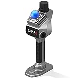
- 1cm High-Precision & 70m Long-Range Scanning: Engineered for demanding terrain and architectural surveying. Equipped with dual 1-inch large-area CMOS sensors delivering 16MP resolution per lens (2.4μm pixel size). It reliably captures spatial data from 0.1 to 40 meters (@ 10% reflectivity) and up to 70 meters (@ 80% reflectivity) for highly accurate 3D mapping.
- 360° LiDAR FOV & Distortion-Free Modeling: Rapidly scan large-area indoor and outdoor spaces in minutes with an expansive 360° × 59° field of view. The built-in mechanical shutter effectively eliminates motion distortion (rolling shutter effect), while dual 16MP ultra-wide cameras (32MP combined) ensure flawless close-range photogrammetry and precise object modeling.
- True-Color Point Cloud with Hardware Sync: Ideal for professional VFX, CGI, and digital twin workflows. Microsecond-level system-wide hardware synchronization ensures perfect alignment of real color and intensity. Combined with global shutter technology, it guarantees the seamless integration of rich color data into highly accurate point clouds.
- Open Algorithm & 3D Gaussian Splatting (3DGS): Designed for advanced, industry-specific pipelines. The system provides raw data accessibility to support custom SLAM algorithm integration, and optimized 3D Gaussian Splatting (3DGS) workflows using precise image pose metadata.
- Complete Software Ecosystem & Multi-Format Export: SHARE Capture and SHARE PointClouds Studio are included for SHARE3DCAM users at no additional software license cost. Preview point clouds in real time on mobile, then process, review, measure, and crop project data on desktop. Export point clouds in PLY, LAS, PCD, E57, and RCS formats, and export CAD floor plan and section drafts as DWG files for downstream CAD and BIM workflows.
What Doxel appears to offer today
Doxel’s current public website describes a different customer workflow from the autonomous rover emphasized in the 2018 coverage. A worker walks the site with a 360-degree camera mounted to a hard hat. Doxel’s computer vision then analyzes the imagery against the customer’s BIM model and schedule.
Outdated Drivers Are Slowing You Down
One free scan finds every outdated or missing driver and matches the right update for your exact hardware.Free scan · exact hardware matchPC Slower Than It Used to Be?
A free scan shows the junk files, broken settings and background clutter dragging Windows down - then fixes them in one click.Free scan · Windows 10 & 11The company currently emphasizes automatic progress tracking, work-in-place measurement, production-rate data, schedule visibility, budget insight, and construction-quality monitoring. Its data-center product page also promotes AI recognition of materials from 360-degree imagery and reports a 99%+ work-in-place accuracy claim.
This does not establish that Doxel has permanently abandoned robotics or LiDAR research. It does establish that the company’s publicly advertised customer workflow is now centered on worker-led 360-degree capture and computer vision, rather than presenting the autonomous LiDAR rover as the standard product.
The change illustrates an important commercial lesson. A worker walking a site with a camera may be less visually impressive than an autonomous robot, but it can be easier to deploy where layouts change daily, stairs and elevators complicate navigation, and a site already has a documentation routine.
Current company claims need context
Doxel’s current marketing materials claim 99%+ accurate work-in-place reporting, correction of multiple $300,000-plus change orders and invoices, and 11% faster project delivery in a data-center context. These are vendor claims, not independently audited benchmarks in the available material.
A buyer should ask what “accuracy” measures. It could refer to component recognition, quantity measurement, percentage complete, or another metric. The buyer should also ask:
- What projects and sample size produced the percentage?
- What was the ground truth?
- Was the comparison against manual reporting, BIM quantities, or an independent audit?
- Does the figure represent an average, a maximum, or an individual project?
- How are partially complete and occluded components treated?
Doxel also says its system can be set up in less than two weeks after receiving the BIM model. That timeline may depend on BIM quality, schedule integration, project readiness, and site conditions.
Rank #4
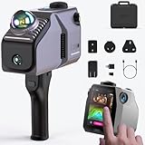
- 🏗️ Ultra-Long Range & High Precision Mapping: Capture objects up to 140 meters away with precision as fine as ±2cm at 10 meters, thanks to advanced LiDAR sensing technology. The scanner uses SLAM (Simultaneous Localization and Mapping) to maintain accuracy during movement, enabling seamless mapping of large, complex spaces. Whether you’re scanning multi-level buildings, outdoor construction areas, or irregular industrial environments, this scanner ensures high-speed, high-precision data capture
- 🎨 8K HDR Color with Multi-Camera System: Equipped with up to four 48MP ultra-wide HDR cameras, this scanner delivers immersive 8K panoramic color detail with rich texture and lighting accuracy. Perfect for projects requiring high-quality visual fidelity, such as digital twin creation, reality capture, 3D asset generation, or architectural modeling. Export options include colored point clouds (PLY) and OBJ mesh models, making it fully compatible with Unreal Engine, Unity, and Blender workflows
- ⚙️ Handheld, Wireless & Portable Design: Weighing just 1.5kg, this scanner is designed for portability and efficiency in fieldwork. The 12,000mAh built-in battery provides up to 1 hour of wireless operation, letting you scan freely without cables. You can easily switch between handheld & fixed scanning modes. Ideal for interior room capture, terrain mapping, urban scanning, or remote site surveys, the lightweight design helps reduce operator fatigue and enhances mobility in diverse environments
- ⚙️ Handheld, Wireless & Portable Design: Weighing just 1.5kg, this scanner is designed for portability and efficiency in fieldwork. The 12,000mAh built-in battery provides up to 1 hour of wireless operation, letting you scan freely without cables. You can easily switch between handheld & fixed scanning modes. Ideal for interior room capture, terrain mapping, urban scanning, or remote site surveys, the lightweight design helps reduce operator fatigue and enhances mobility in diverse environments
- 🔧 Easy Setup, Fast Deployment, No Calibration Needed: Forget the lengthy setup time of traditional LiDAR systems. The plug-and-play design of this 3D scanner requires no manual calibration, reducing prep time by up to 50%. Start scanning within minutes and get consistent results in both indoor and outdoor conditions. It’s ideal for professionals working in real estate virtual tours, industrial site inspections, mining documentation, and environmental digitization.
Where this technology is most useful
Doxel’s approach is most compelling on large, complex projects where small errors multiply quickly:
- Data centers with repetitive components and demanding schedules.
- Healthcare construction with dense mechanical, electrical, and plumbing systems.
- Commercial projects involving many trades and handoffs.
- Projects with high rework, delay, or change-order exposure.
- Owners and contractors managing multiple similar projects and seeking production benchmarks.
It is less attractive when a project lacks a reliable BIM model or schedule, is too small to justify implementation, or has no process for acting on the information. Technology cannot produce a dependable comparison against a baseline that is incomplete, outdated, or poorly coordinated.
Important limitations and failure modes
Visibility is not the same as completion
LiDAR and cameras can only assess what they can capture. Stored materials, scaffolding, temporary walls, equipment, workers, and other trades can block components. A “not detected” result may mean “not installed,” “not visible,” or “not successfully captured.” A robust workflow needs confidence scores, rescan procedures, and human review.
Hidden work remains difficult
Once a wall, ceiling, or floor is closed, visual and geometric capture cannot by itself prove what is behind it. Nor can LiDAR establish whether a connection is correctly torqued or sealed, whether a concealed installation meets code, or whether a component operates properly.
BIM quality determines much of the result
A system may accurately compare the site with the wrong baseline. Design changes, revised models, missing components, coordinate-system problems, and poor work-breakdown structures can all create misleading outputs.
Autonomous navigation is difficult on active jobsites
Construction sites change constantly. Robots must cope with moved materials, open shafts, temporary ramps, wet or dusty surfaces, blocked routes, elevators, stairs, active equipment, and changing security rules. A pre-scheduled route is not the same as unrestricted autonomy in an arbitrary environment.
Data governance and liability matter
Before deployment, owners and contractors should clarify who owns imagery, point clouds, annotations, and derived metrics; how long data is retained; whether workers are identifiable; whether data can be used to train models; whether reports become contractual records; and who is responsible when an AI system misclassifies progress.
Best Value

- 50m Long-Range LiDAR Scanning: Capture large indoor and outdoor environments with a powerful 50-meter scanning radius. Ideal for architecture, construction sites, urban streets, warehouses, stadiums, caves, and landscape mapping projects.
- Advanced SLAM for Stable Spatial Capture: Enhanced SLAM algorithms combine point cloud, image, IMU, and GPS data to reduce drift during movement, delivering smoother alignment and more reliable 3D reconstruction results.
- Professional Accuracy with Ultra-Wide FOV: Featuring up to 2cm accuracy and a 360° × 40° ultra-wide field of view, Raven minimizes blind spots and improves single-pass scanning efficiency in complex environments.
- Stunning 4K True-Color Reconstruction: Single 12MP fisheye cameras automatically adapt to lighting conditions to capture vivid 4K imagery, realistic RGB point clouds, and immersive Gaussian Splatting scenes.
- Lightweight Portable Design: Weighing only 1.1kg, Raven is designed for mobile workflows and field operation. Its compact handheld body makes scanning easier across indoor and outdoor job sites.
How Doxel compares with other construction-robotics categories
Doxel should not be compared directly with every construction-robotics company. The market contains several distinct categories.
- Positronic Bot: A more explicitly robot- and LiDAR-centered construction-intelligence platform using a quadruped, RGB sensing, edge AI, mapped routes, BIM comparison, remote inspection, and as-built documentation.
- Built Robotics: Focuses on autonomous heavy construction equipment, including piling systems for utility-scale solar. Its machines perform physical construction work rather than primarily measuring progress.
- Advanced Construction Robotics: Offers TyBOT for robotic rebar tying and IronBOT for rebar handling and placement. The company advertises TyBOT at more than 1,200 rebar intersections per hour; that is an ACR claim, not a general industry benchmark.
- Gritt: Markets AI and robotics for construction and infrastructure operations, with vendor claims including seven-plus jobsites and four-times efficiency without additional labor.
- Gravis Robotics: Develops autonomous excavation using AI, LiDAR, cameras, GNSS, and machine data. The company claims a 30% output increase.
These products address different bottlenecks. Doxel is primarily about progress intelligence and work-in-place measurement; other companies automate rebar, piling, excavation, or broader physical operations.
A practical evaluation checklist
Owners and contractors considering a platform like Doxel should evaluate the complete workflow, not just the sensor.
Do these 3 things before closing this tab:
1Repair Windows errors before they cause bigger problems2Fix the driver behind crashes, sound loss and screen glitches3Clear out junk files and repair common Windows errors- Capture: Is the system autonomous, worker-operated, drone-based, or hybrid? Can it operate around stairs, clutter, changing routes, and active work?
- Data: Which BIM formats and schedule systems are supported? How are design changes and revised models handled?
- Outputs: What is measured—components, quantities, percentage complete, deviations, production rates, or schedule risk?
- Quality: What are the false-positive and false-negative rates? Is there an audit trail and a human correction process?
- Timing: How often must the site be captured, and how long does processing take?
- Commercial value: Will the information reduce reporting labor, avoid rework, resolve payment disputes, or provide earlier schedule intervention?
- Implementation: Who walks the site, maintains the model, reviews alerts, and acts on the results?
No reviewed vendor publishes enough standardized pricing to support a meaningful cost-per-project comparison. A serious evaluation should therefore use a defined pilot and measure reporting time, detection lead time, avoided rework, forecast accuracy, and adoption by project teams.
The lasting lesson from Doxel
Doxel’s original LiDAR robot attracted attention because it combined autonomous navigation, 3D sensing, and AI on a construction site. But the durable idea is broader: construction productivity improves when work becomes measurable early enough for people to correct it.
The 2018 robot story should therefore be read as a historical account of Doxel’s early approach, not as a guarantee that the same rover remains the company’s main commercial product. Today’s public positioning points toward worker-captured 360-degree imagery and AI-driven progress tracking. The hardware may have become simpler, but the core objective remains the same: connect what is physically on the site with what the project planned to build, then make deviations actionable before they become expensive.
Quick Recap
Product prices and availability are accurate as of the date/time indicated and are subject to change. Any price and availability information displayed on Amazon at the time of purchase will apply.
What’s actually slowing this PC down?
Pick the symptom - the matching free tool is one click away.

