Choose Waze first when your priority is fast, detailed awareness of construction, lane closures, hazards and detours while driving. Choose Google Maps when the trip also involves finding places, walking, public transit or broader itinerary planning. The services now share part of their incident information, so neither is universally more accurate. Local reporting activity, transportation-agency feeds, connectivity, app version and the age of an alert can matter more than the logo on your phone.
The practical verdict
For a commute through active roadwork, Waze is the better starting point because its driver-focused interface exposes construction and other road-report categories and is built around live route changes. You can keep construction and closure alerts visible, and Waze supports detailed community reports, including conversational voice reporting for events such as construction and potholes.
As an Amazon Associate I earn from qualifying purchases.
Google Maps is a credible alternative rather than a separate information universe. Google said on July 31, 2024, that Maps had made it easier to report construction, lane closures, objects and police presence. Maps can display reports originating in both the Maps and Waze communities and identify which app supplied a report. Its advantage is context: the same app can handle place discovery, walking, transit and a mixed-mode itinerary.
Recommended Free Tools
Use both before an important trip that crosses a known work zone or major closure. Compare the route, look at the incident age and check the local transportation agency or 511 service for planned projects. During the drive, obey signs, cones, flaggers and police instructions even when an app shows a different route.
#1 Best Overall
![Compact Foldable Car Phone Holder for Magsafe [78+LBS Strongest Suction & 2400gf Strongest Magnetic] 360° Adjustable Car Phone Mount, Bedstand & Desk Mounts for iPhone 18-12 Pro Max (Carbon Fiber)](https://m.media-amazon.com/images/I/41y4I4lyhVL._SL160_.jpg)
- 360° Rotation & Dual-Axis Adjustment: This car phone holder features a 360° rotating base and 210° dual-axis folding metal arms, allowing easy angle adjustments to suit your needs. Whether in the car or at the office, switch between portrait and landscape modes effortlessly. Its unique folding design reduces the mount's size by 50% when not in use, keeping your space tidy. It remains stable and reliable even after 3000+ durability tests, ensuring long-term performance you can trust. (Protected by US Design Patent No. US D1,076,905 S)
- Strong Suction & Stable Hold: This car phone mount uses advanced rotating-lock vacuum suction, boosting suction by 45% compared to traditional press-on mounts. It stays stable on bumpy roads or during sudden stops. The 4-layer high-strength nano gel suction cup supports up to 78lbs and holds firm in extreme temperatures (-40°F to 300°F). Even after 9999+ durability tests and 200+ reattachments, it continues to deliver powerful suction and lasting stability.
- Stronger Magnetic Force: With 22 high-performance N55 magnets, this mount's magnetic strength is 200% stronger than standard magnets, providing a top-tier hold with up to 2400gf of force. It can support the weight of up to 50 phones. After 5000 vibration tests and extreme road simulations, your phone stays secure during bumps, sudden stops, or sharp turns. It keeps your phone securely in place during bumps, turns, and sudden stops without disrupting signal performance.
- Circular Cooling Design: This magnetic phone holder for cars features a unique circular vent design that reduces contact between your phone and the holder, improving airflow and preventing overheating. Whether you're using GPS on a long drive or video calling during your commute, it keeps your phone cool, extending battery life and ensuring smooth performance. This helps keep your phone cool, efficient, and performing smoothly throughout the entire drive.
- Broad Compatibility & 1s Easy Installation: This cell phone car mount is designed for iPhone 18/17/16/15/14/13/12 series and for all MagSafe devices, plus it includes a magnetic ring to provide the same strong magnetic hold for non-MagSafe phones. Whether your phone is bare or in a case, it attaches in just one second with one hand. Its exceptional compatibility works with various car models, ensuring a secure and easy fit in any vehicle. Its wide compatibility ensures quick installation, strong attachment, and an easy fit across different phones and vehicles.
What each app is actually good at
| Reader need | Waze | Google Maps |
|---|---|---|
| Granular driver reports | Strong fit: construction and multiple incident categories are exposed in alert and reporting controls. | Improving: Maps accepts incident reports and can surface reports from both communities. |
| Planned closures | Supports closure submissions and agency feeds through Waze for Cities. | Receives some shared agency and community information through the Google-Waze ecosystem. |
| Live route response | Driver-focused live routing; an active internet connection is required for the initial route, live traffic updates and hazard processing. | Live routing and incident display are available, but exact alert and reroute behavior depends on the current app version and local data. |
| Reporting while driving | Conversational reporting can classify spoken reports such as construction and potholes. | Google has simplified incident reporting and shares some Waze-originated reports. |
| Broader trip planning | Primarily driving-oriented. | Better suited when a trip includes place discovery, walking or transit planning. |
Those distinctions describe product focus, not a controlled accuracy ranking. A quiet rural route with few active contributors can produce less timely information in either service than a busy metropolitan corridor with constant driver and agency updates.
How construction and detour information gets into the map
Community reports
Waze builds many road-feature alerts from reports by partners, map editors and drivers. Waze’s help guidance states that if a road feature was not reported, Waze may not know about it. A driver can therefore encounter genuine work that is absent from the map, especially when a contractor changes traffic control quickly or when a location has little reporting activity.
Google Maps and Waze now overlap more in the incident layer. Google’s July 2024 announcement says Maps reports can cover nearby construction, lane closures, objects and police presence, with information coming from Maps and Waze communities. Maps may show which app supplied a report, giving you useful provenance when two alerts appear to describe the same obstruction.
Do these 3 things before closing this tab:
1Clear out junk files and repair common Windows errors2Scan for outdated or missing drivers - takes under a minute3Repair Windows errors before they cause bigger problemsPlanned closure submissions
Waze supports a closure-submission process for planned restrictions. The time a closure report remains visible changes according to how many Wazers react to it, so a report is not a permanent guarantee that a detour will remain on screen. A project that is extended, shortened or staged differently can require a new or updated report.
Transportation-agency feeds
Official agencies can provide planned construction, road closures, major-event routes and real-time hazards through Waze for Cities. Those feeds can reach drivers on both Waze and Google Maps. In practice, a well-integrated local authority feed may be more valuable than choosing one consumer app over the other. Check the transportation department’s project page or 511 service for the authoritative schedule, phases and emergency instructions.
Set up Waze for construction-heavy driving
Menu names can vary by operating-system version and region, but the process is consistent: enable road-work categories, make sure alerts can appear on the map and confirm that the phone can maintain a data connection.
Rank #2

- Never Fall Off-Metal Hook Design: Miracase car phone holder adopts simplified locking design. The steel metal hook(with silicone pad and mat) will catch one of car air vent blades and provide excellent strudiness. It will work well for your car even in extremely harsh environments. NOTE: ONLY Compatible with horizontal and vertical vents. Not suitable for round vents.
- Universal Compatibility: Miracase cell phone stand for car mount is compatible with the smartphones (4.0-7.2 inches) and thicker cases. Note!!The lengh of vent clip hook is MAX 1.4inch(3.6cm), it will be compatible with vent blades less than 1.4 inches (3.6 cm) wide. NOTE:Not suitable for Round Vent.
- One-hand Operation: With quick release button, adjustable clamp arms and foot, Miracase car phone mount makes it very easy to insert and remove your phone with single hand. Provide you with safer driving whether you are talking, navigating or listening to music or charging.
- 360-degree Flexible Rotation: The 360-degree rotatable design will provide you with the best viewing angle to keep secure driving. You can place your phone in any orientation (landscape, portrait and more), Just enjoy the best drving experience
- Professional Support: Please contact us for any product issues, a satisfying solution is promised forever
- Open Waze before leaving and open its settings and alert/report controls.
- Turn on construction and closure-related categories, along with any other hazards you want to see. Waze allows users to choose whether alerts show on the map.
- Review the route overview for construction, closures and incident markers before starting navigation.
- Start navigation while connected to mobile data or Wi-Fi so Waze can calculate the initial route.
- Keep the app in a visible, hands-free position and use voice reporting when available instead of typing while moving.
Waze requires an active internet connection—5G, LTE or Wi-Fi—to calculate initial routes, update live traffic and process hazard reports. A downloaded or previously viewed map cannot substitute for those live functions. If coverage drops, rely on posted signs and your last known route until the connection returns.
Quick wins for a faster PC:
Clear out junk files and repair common Windows errorsFree Scan →Scan for outdated or missing drivers - takes under a minuteDriver Scan →What Waze alerts do and do not mean
- A construction marker means someone or an agency supplied information; it does not prove that every lane is closed at the moment you arrive.
- A closure can disappear when reactions decline or when the report ages, even if physical work continues.
- A missing marker does not prove that the road is clear. Waze explicitly warns that unreported features may be unknown to the service.
- Voice classification can make reporting safer and faster, but you still need to keep attention on traffic and follow local hands-free laws.
Use Google Maps when context matters
Google Maps is often the better single app when construction is only one part of the trip. You can investigate a destination, compare walking or transit legs, find a park-and-ride location or plan several stops without switching products. Its incident layer is also improving: Google says Maps can accept reports about construction, lane closures, objects and police presence and may display reports from Waze users.
- Open Maps and enter the destination, then inspect the route overview before departure.
- Look for construction, lane-closure and obstruction indicators and note the apparent age or source when Maps provides it.
- Compare alternate routes, especially if the route crosses a bridge, interchange or work zone with limited escape options.
- For a multimodal trip, check the driving leg and the walking or transit leg separately; a detour that helps a car may not apply to a bus or pedestrian connection.
- Recheck the map immediately before leaving because incident status can change between planning and departure.
Google does not publish one universal rerouting rule for every app version and location. The alert and route response you see depend on current software, local data and the incident’s treatment by the mapping system.
A reliable pre-trip workflow for major roadwork
When a closure could make you late or strand you on a limited-access road, spend a few minutes using the two apps together rather than assuming one has complete coverage.
- Identify the project. Search the local transportation agency, project dashboard or 511 service for the official work-zone limits, dates, hours and phases.
- Preview in Waze. Look for driver reports, closure markers and a route that reflects current traffic.
- Preview in Google Maps. Check whether Maps shows a different incident, source attribution or a useful alternate route.
- Check the timestamp. A fresh report is more relevant than an old marker, but freshness is not proof; compare it with signs and agency notices.
- Choose a fallback. Save an alternate route or identify a safe place to stop if traffic control changes after you depart.
- Leave time for the unexpected. A project can shift from shoulder work to a lane or ramp closure without enough notice for an app update.
How to interpret detour alerts while driving
When the app suggests a reroute
Read the route change as a recommendation, not an instruction. Confirm that the proposed road is open, legal for your vehicle and appropriate for the weather and time of day. A shortcut through local streets may move congestion into a residential area or send a large vehicle beneath a low clearance. If a police officer, flagger or temporary sign directs traffic elsewhere, follow that direction.
What’s actually slowing this PC down?
Pick the symptom - the matching free tool is one click away.
When signs contradict the phone
Physical traffic control takes priority. Construction crews can close a lane seconds before a report is filed, and a map can retain an incident after crews reopen the road. Slow down, merge as directed and avoid stopping in a travel lane to adjust the route. Pull over safely before changing settings.
Rank #3
![3-in-1 Car Phone Holder [122+LBS Strongest Suction & Stable Clamp Arm] 360° Adjustable Car Phone Mount, Cell Phone Holders for Your Car for Dashboard Vent, All Smartphones & Car Models](https://m.media-amazon.com/images/I/41zXJmKupNL._SL160_.jpg)
- 3 in 1 Ultimate Car Mount - Leading in innovation, we introduce our eagerly awaited car phone holder. Featuring a 360° rotating suction base for easy side-to-side adjustments without reinstallation. Our unique double hook metal clip protects air vents from scratches and offers unparalleled stability, enhancing your device's security by 500%. Designed to adapt to different driving angles while maintaining stable and consistent visibility.
- Unrivaled Adhesion & Stability - Featuring a 3-layer high-viscosity, reusable nano gel with a unique powerful air-pressure valve that enables ACMEZING cell phone car mount to handle 122 pounds+ loads and extreme temperatures (-104°F to 214°F). Whether you're in Florida's heat or Alaska's cold, this phone mount for car securely sticks in your cockpit without any risk of melting or warping. The reusable suction design allows adhesion to be restored after cleaning while remaining suitable for common mounting surfaces.
- Industry First'double Metal Clip - Our phone holder car comes with double metal hook that provides a 50% larger contact area and extends up to 4cm in length. With its double hook metal clip and double triangle structure, it offers more than 5 times the stability compared to the conventional clip. This ensures absolute stability even during sudden stops, sharp turns, and bumpy rides. Engineered to provide secure vent mounting without interfering with vent adjustment or airflow.
- Effortless Installation & 99% Compatibility - Streamline your driving experience with our iphone car mount. Fast, easy, and hassle-free phone attachment and detachment in a click. Simplify complexity, enjoy your journey! The up and down position adjustable holder design is built to not obstruct headphone and charging cables, as well as volume and power buttons. Designed for everyday use, it maintains easy access to your device without affecting normal vehicle or phone operation.
- Uncompromising Quality - At ACMEZING, we are dedicated to your satisfaction, offering trusted products like our car phone holder mount for those who seek a high-quality lifestyle. ACMEZING focuses on dependable design, consistent performance, and reliable customer support.
When no alert appears
Absence of an alert is not evidence that no work exists. Agency integration, local participation, map-editor coverage and signal availability all affect what reaches your screen. Treat every unfamiliar cone pattern, temporary signal or pavement marking as current information even when the map looks normal.
Why local participation changes the result
Both services depend on a mix of automated processing, official data and human reports. A city with many active drivers may produce rapid confirmation of a new lane closure. A low-volume county may depend mainly on an agency feed, and a feed that is delayed or not integrated can leave both apps behind field conditions.
Waze’s report duration illustrates this local and social component: the time a closure remains visible changes according to Wazer reactions. That mechanism can help highly active communities keep important events visible, but it also means the screen is a living representation of reports rather than a fixed engineering record.
Google’s ability to display Waze-originated incidents reduces the value of treating the two databases as completely independent. Their routing priorities and interfaces remain different, yet a report may appear in both places. Compare source attribution and route treatment instead of counting an alert twice.
Connectivity, phone placement and safe use
Live construction awareness requires connectivity. Waze explicitly requires an active 5G, LTE or Wi-Fi connection for initial route calculation, live traffic updates and hazard processing. Google Maps also needs current data to display changing incidents and recalculate a route. In a weak-signal corridor, download or previewing a route can help with basic orientation, but it cannot guarantee current closure information.
Mount the phone where it is visible without blocking the windshield, instruments or airbags. A universal dashboard smartphone mount, car phone holder or hands-free navigation mount can support either app; verify that the mount fits your phone, dashboard or vent and remains secure on rough roads. Do not handle the phone while moving. Set the destination, alert preferences and audio before departure, and pull over when a change requires more attention.
Rank #4
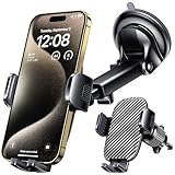
- 3 IN 1 Phone Holders for Your Car: Cell phone GPS navigation holder car is equipped with a suction cup and vent clip, which can be freely mounted on the windshield, dashboard, and air vent for feeding your different usage needs. Cell phone Camera Mounts holder is applied to most cars, pickup trucks, SUVs, taxis. A perfect assistant for Uber, Lyft drivers.
- Enhanced Powerful Suction Cup: Phone GPS navigation holder mount is equipped with double-lock suction cup and uses heat-resistant TPU material , which can provide strong suction power on smooth surfaces, and keep the mount stable in any conditions. To restore adhesion, simply rinse the sticky surface with warm water and wipe dry.
- Perfect Flexibility: Car phone Camera Mounts holder with 360 degree ball joint and adjustable telescopic arm, which can adjust your phone to any ideal angle without obstructing your view. The telescopic arm can be extended from 6.5 inches to 8.1 inches. Easily adjust the distance between you and the car mount.
- Full Protection: iPhone car mount with vacuum silicone rubber and thick panels can provide full protection for your phone from scratches and drops even at high speeds, bumps or turns.
- Easy Operation: Car mount for iPhone has a one-touch release button, you can release your phone with one hand while driving. Adjustable feet accommodate all 4-7 inch phones and most thick cases.
What available evidence says—and what it does not
The 22% preference figure
A 2023 U.S. Department of Transportation transportation research report found that 22% of surveyed participants preferred navigation apps such as Google Maps and Waze when asked about future construction-project detour information. This is a preference statistic, not a test of whether either app detects closures faster or routes drivers more accurately.
The Tool Desk
Outbyte Driver Updater FREEFix the driver behind crashes, sound loss and screen glitchesFind Drivers →Outbyte PC Repair FREERepair Windows errors before they cause bigger problemsFix Now →Waze’s reported scale
The Associated Press reported in 2024 that Google described Waze as having roughly 180 million monthly users while discussing new artificial-intelligence and incident-reporting features. That number indicates reach and potential reporting density; it does not establish the accuracy of any particular alert or location.
No universal accuracy winner
No current independent, apples-to-apples measurement establishes that Waze or Google Maps is universally more accurate for construction and detour alerts. Results can change with local participation, agency feeds, app version, mobile coverage and report age. The defensible conclusion is conditional: Waze is the stronger alert-first choice for many drivers, while Google Maps is the stronger all-purpose planning choice.
Decision guide by trip type
Daily commute through active work zones
Start with Waze, keep construction and closure alerts enabled and preview the route before leaving. If the corridor is notorious for overnight phases or ramp closures, check the agency notice as well.
Long-distance trip with uncertain conditions
Check both apps and the relevant state or regional 511 service. Use the app that shows the clearest current incident information, but retain an alternate route and extra time.
PC Slower Than It Used to Be?
A free scan shows the junk files, broken settings and background clutter dragging Windows down - then fixes them in one click.Free scan · Windows 10 & 11Crashes, No Sound, or Screen Glitches?
Random freezes, missing sound and display glitches usually trace back to one bad driver. Find and replace yours safely.Free scan · under a minuteTrip combining driving and transit
Use Google Maps for the complete itinerary, then inspect the driving leg for construction and the transit agency’s own service notices. A road detour can affect a bus route differently from a private car.
Best Value
![[True Military-Grade] Car Phone Holder VANMASS [Upgraded Strongest Suction&Clip] Cell Phone Mount for Dashboard Windshield Vent Kit, Truck Cradle Stand for iPhone 18 Pro Max 17 16 15 Android,Ink Black](https://m.media-amazon.com/images/I/512X87YSVuL._SL160_.jpg)
- 【True Military-Grade Certified, Ultimate Upgraded Model】Over the past decade of specializing in high-end car mounts, VANMASS have listened to the voices of millions users, rigorously tested to MILITARY GRADE standards (stability, compatibility, flexibility, security, durability). Finally, we overcome all weaknesses to design the Ultimate Model. This item obtained international military-grade shockproof certification No. GZMR220601855501
- 【Larger Suction Cup, Strongest Suction】The diameter of the suction cup has been increased from 2.5in to 2.8in, and the PU adhesive has been applied to increase the suction power by 44%. Over 85 pounds of suction means even the heaviest phones are secure on bumpy roads. The suction cup is easy to remove and can be washed clean and reused. Attention: Install suction cup on a flat surface, avoiding curves or leather surface
- 【Multi-Function Phone Stand for Dashboard / Windshield / Vent】Are you not sure which installation would best suit your vehicle? No problem the unit is extremely flexible!!! Dashboard, Windshield even air vent, all places work perfectly!
- 【Longer & Firmer Hook Clip - Fit 99% vent】Its innovative hooked construction perfectly solves the shortcomings of the previous generation air vent clips which were prone to loosening! Maximum hook length increased by 57%, compatible with 99% Vertical / Horizontal vent. Longer build reduces obstruction of air flowing out of vent. Attention: Hook is not compatible with round, cross, or diagonal car vents
- 【High-end = Quality Materials + Grandmaster Design】VANMASS car phone mount made of PC+ABS material has passed 4 environmental reliability tests and has a temperature resistance range of -40℉ to 194℉, it is also highly resistant to UV rays (Ensuring reliability even in the sun), and the telescopic pole uses a reinforced sliding rail structure to greatly reduce wobbling during driving. This suction phone cradle obtained CP65 / REACH / RoHS safety certifications
Reporting a newly discovered closure
Use Waze’s conversational reporting when available and legal to do so hands-free. Describe the event clearly, then leave the road decision to signs, traffic-control personnel and safe driving judgment.
Questions drivers often ask
Does Google Maps include Waze construction reports?
Google said in July 2024 that Maps can show incident reports from both Maps and Waze communities and can identify the originating app. Coverage still depends on local data and the current app version.
Can Waze guarantee that every work zone appears?
No. Waze says road features are added from partner and map-editor reports and that an unreported feature may be unknown to Waze.
Should I leave both apps running at once?
Usually no. Running two navigation apps simultaneously can create distracting instructions and extra battery and data use. Preview both before departure, then use one hands-free navigation source while consulting official notices when needed.
What should I do if the route changes repeatedly?
Pull over safely, review the official project information and select a route that matches posted traffic control. Repeated changes can indicate rapidly changing work, stale reports or unstable connectivity.
Bottom line for construction and detour alerts
Waze is the best first choice for drivers who want granular, community-driven construction and hazard awareness during a live trip. Google Maps is the better broad trip planner and now benefits from incident sharing across the Maps and Waze communities. For high-consequence journeys, combine either app with official transportation-agency or 511 information, verify what you see against the road and never treat an app as a substitute for traffic-control signs or instructions.
Quick Recap
Product prices and availability are accurate as of the date/time indicated and are subject to change. Any price and availability information displayed on Amazon at the time of purchase will apply.
Free tools Windows power users keep installed
One-click scans. No signup required.

