The Tool Desk
Outbyte Driver Updater FREEFix the driver behind crashes, sound loss and screen glitchesFind Drivers →Outbyte PC Repair FREEClear out junk files and repair common Windows errorsFree Scan →For most north–south trips around Baltimore Harbor, use either I-95 through the Fort McHenry Tunnel or I-895 through the Baltimore Harbor Tunnel. The Key Bridge segment of I-695 remains closed, and neither tunnel is always the faster choice: compare live traffic on Maryland’s CHART map and check whether your vehicle or cargo is allowed through a tunnel before you leave.
Which route should you take?
Maryland transportation agencies identify I-95 and I-895 as the standard alternate harbor crossings. The right option depends on your starting point, destination, current traffic and vehicle. Official guidance does not establish a universally fastest route or a current travel-time comparison for a particular trip.
| Route | Crossing | When to consider it | What to check |
|---|---|---|---|
| I-95 | Fort McHenry Tunnel | North–south trips when the route fits your endpoints and live conditions. | Traffic, incidents and cameras on CHART; tunnel restrictions for your vehicle or cargo. |
| I-895 | Baltimore Harbor Tunnel | North–south trips when the route fits your endpoints and live conditions. | Traffic, incidents and cameras on CHART; tunnel restrictions for your vehicle or cargo. |
| I-695 between Essex and Glen Burnie | Not a tunnel crossing | Vehicles carrying materials prohibited in tunnels, including recreational vehicles carrying propane, should follow Maryland SHA’s guidance to use this route. | Confirm restrictions for your specific vehicle and load, and allow for significant additional driving time, as SHA warns. |
These are agency route directions, not a promise that a route is open without delay or suitable for every vehicle. MDTA lists I-95 and I-895 as alternate harbor routes; Maryland SHA specifies the Fort McHenry and Baltimore Harbor tunnels for north–south travel. See the MDTA Key Bridge facility notice and Maryland SHA’s detour guidance.
How to compare the tunnel routes before leaving
- Check your trip endpoints. Compare how I-95 and I-895 fit your origin and destination rather than choosing by tunnel name alone.
- Open Maryland’s CHART real-time traffic map. Review current traffic volumes, live cameras and incidents before departure.
- Choose using the conditions at your departure time. Recheck if you delay your trip; a route that looks preferable earlier may not remain so.
Maryland SHA reported heavier-than-normal conditions on I-95, I-895 and I-695 after the bridge collapse in an April 9, 2024 advisory. That is historical context, not a current congestion reading. CHART is the appropriate place to check conditions for your trip.
#1 Best Overall

- Bright, high-resolution 5” glass capacitive touchscreen display lets you easily view your route
- Get more situational awareness with alerts for school zones, speed changes, sharp curves and more
- View food, fuel and rest areas along your active route, and see upcoming cities and milestones
- View Tripadvisor traveler ratings for top-rated restaurants, hotels and attractions to help you make the most of road trips
- Directory of U.S. national parks simplifies navigation to entrances, visitor centers and landmarks within the parks
Check tunnel restrictions for your vehicle and cargo
Do not assume that the ordinary passenger-car detour applies to a vehicle carrying restricted materials. Maryland SHA says vehicles carrying materials prohibited in tunnel crossings—including recreational vehicles carrying propane—should use I-695 between Essex and Glen Burnie, and warns that this route will add significant driving time. Confirm that the rule applies to your specific vehicle and load using the SHA detour guidance.
Commercial, oversize or overweight trips need a permit check
If a commercial vehicle permit routes you over the closed Key Bridge segment, Maryland SHA says the route needs to be rerouted through the Maryland One permit system. Oversize and overweight operators should check current permit requirements rather than rely on the ordinary-car detour. For help with a permit that used the Key Bridge route, consult SHA’s Commercial Vehicle Operations page and contact the permit office as directed there.
Rank #2

- 6” high-resolution navigator includes map updates of North America
- Hands-free calling when paired with your compatible smartphone with BLUETOOTH technology and convenient Garmin voice assist lets you ask for directions to places you want to go
- Road trip–ready features include the HISTORY database of notable sites, a U.S. national parks directory, Tripadvisor traveler ratings and millions of Foursquare POIs
- Driver alerts for things such as school zones, sharp curves and speed changes help encourage safer driving and increase situational awareness
- Access live traffic, fuel prices, parking, weather and smart notifications when you pair this navigator with your compatible smartphone running the Garmin Drive app
Know what the closure status means for your route
The Key Bridge segment of I-695 is closed in both directions. USDOT’s Federal Register notice records the closure beginning March 26, 2024, and says it continues indefinitely until the damaged bridge can be reconstructed. MDTA identifies the closure points as MD 173 on the outer loop and MD 157/Peninsula Expressway on the inner loop. Check the USDOT/FHWA closure notice and MDTA facility page, as well as live conditions, before traveling.
The rebuild is project context, not a basis for choosing between today’s routes. In an October 1, 2026 announcement, the Governor’s office described a dashboard updated monthly and reported construction progress as of that date: permanent south tower supports were 55% complete, north tower supports 26% complete, and temporary work platforms 99% complete. The announcement says the planned replacement bridge is to exceed two miles in length, with a minimum 230-foot vertical clearance in the navigation channel. These are dated project figures, not a traffic forecast. See the Key Bridge rebuild dashboard announcement.
Quick Recap
Rank #3
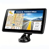
- 【Map Updates】 This car GPS comes pre-installed with the complete 2026 North America maps and supports free lifetime updates. If you need maps for Europe or other regions, please contact us to download.
- 【Smart Voice Alerts】 This GPS navigation system provides clear turn-by-turn voice guidance, and also alerts you to speed limits and school zones, helping you drive more safely.
- 【Custom Truck Routing】 Supports multiple modes including Car, Truck, Bus, RV, Bicycle, and Pedestrian. In Truck/RV mode, the system automatically avoids low bridges, weight-restricted roads, and narrow lanes.
Product prices and availability are accurate as of the date/time indicated and are subject to change. Any price and availability information displayed on Amazon at the time of purchase will apply.